Oficina de Correos
Oficina de Correos is a post office in San Blas - Canillejas, Madrid, Community of Madrid. Oficina de Correos is situated nearby to the military installation Acuartelamiento San Cristóbal (AGTP), as well as near the church Parroquia Virgen de La Candelaria.| Tap on a place to explore it |
Places of Interest Nearby
Highlights include Riyadh Air Metropolitano and Las Musas.
Riyadh Air Metropolitano
Stadium

Photo: Fernandopascullo, CC BY-SA 4.0.
Metropolitano Stadium, also referred to as Riyadh Air Metropolitano Stadium for sponsorship reasons, is a football stadium in Madrid, located in the Rosas neighbourhood in the San Blas-Canillejas district. Riyadh Air Metropolitano is situated 1¼ km east of Oficina de Correos.
Las Musas
Metro station

Photo: Draceane, CC BY-SA 4.0.
Las Musas is a station on Line 7 of the Madrid Metro, named for the nearby Calle Musas. It is located in fare Zone A. Las Musas is situated 670 metres east of Oficina de Correos.
San Blas
Metro station
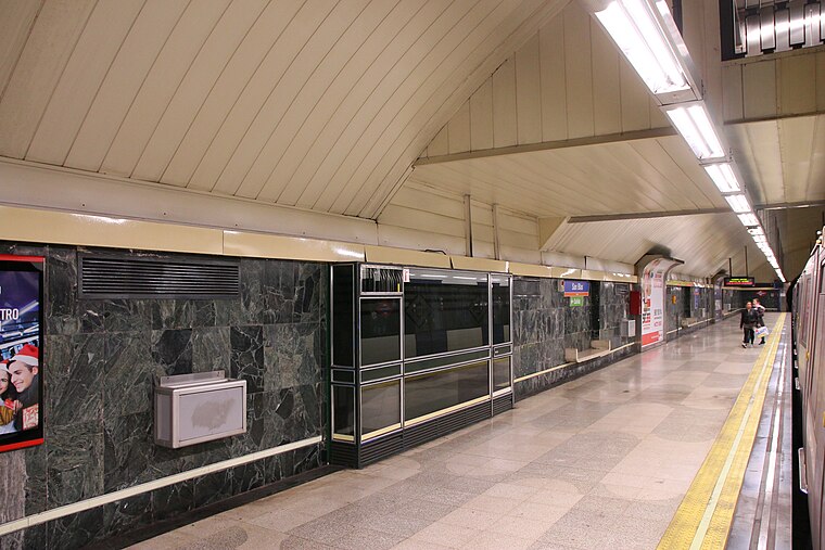
Photo: Draceane, CC BY-SA 4.0.
San Blas is a station on Line 7 of the Madrid Metro, serving the San Blas-Canillejas barrio. It is located in fare Zone A. San Blas is situated 790 metres south of Oficina de Correos.
Places in the Area
Nearby places include Hellín and Simancas.
Hellín
Quarter

Photo: Michiel1972, CC BY-SA 3.0.
Hellín is an administrative neighborhood of Madrid belonging to the district of San Blas-Canillejas. It has an area of 0.549031 km2. As of 1 March 2020, it has a population of 9,403.
Simancas
Quarter

Photo: Michiel1972, CC BY-SA 3.0.
Simancas is an administrative neighborhood of Madrid belonging to the district of San Blas-Canillejas. It has an area of 2.278418 km2. As of 1 February 2020, it has a population of 28,799.
Canillejas
Quarter

Photo: Malopez 21, CC BY-SA 4.0.
Canillejas is an administrative neighborhood of Madrid, belonging to the San Blas-Canillejas district. It is named after the former namesake municipality, absorbed by Madrid in 1949.
Oficina de Correos
- Type: Post office
- Location: San Blas - Canillejas, Madrid, Madrid, Community of Madrid, Central Spain, Spain, Iberia, Europe
- View on OpenStreetMap
Latitude
40.43454° or 40° 26′ 4″ northLongitude
-3.61533° or 3° 36′ 55″ westOpen location code
8CGRC9MM+RVOpenStreetMap ID
node 3039584168OpenStreetMap feature
amenity=post_office
This page is based on OpenStreetMap, Wikidata, and Wikimedia Commons.
We’d love your help improving our open data sources. Thank you for contributing.
Satellite Map
Discover Oficina de Correos from above in high-definition satellite imagery.
In Other Languages
“Oficina de Correos” goes by many names.
- Spanish: “Oficina de Correos”
Places with the Same Name
Discover other places named “Oficina de Correos”.
Notable Places Nearby
Highlights include Acuartelamiento San Cristóbal (AGTP) and Parroquia Virgen de La Candelaria.
Nearby Places
Explore places such as Subestación de Canillejas and Arcentales-Avenida de Canillejas.
Madrid: Must-Visit Destinations
Delve into Sol-Letras-Lavapiés, Salamanca, Retiro-Paseo del Arte, and Chamberí-Castellana.
Curious Post Offices to Discover
Uncover intriguing post offices from every corner of the globe.
About Mapcarta. Data © OpenStreetMap contributors and available under the Open Database License". Text is available under the CC BY-SA 4.0 license, except for photos, directions, and the map. Photo: DonPaolo, CC BY-SA 3.0.