Corrientes y Pueyrredón
Corrientes y Pueyrredón is a bus stop in Balvanera, Comuna 3, Buenos Aires, Buenos Aires. Corrientes y Pueyrredón is situated nearby to the shopping center Paseo de Compras La Playa, as well as near Gran América.| Tap on a place to explore it |
Places of Interest Nearby
Highlights include Pueyrredón and Corrientes.
Pueyrredón
Metro station
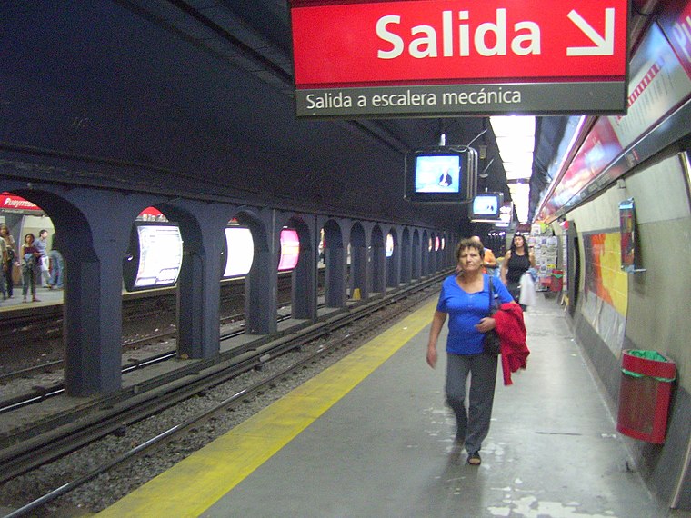
Photo: Ojota, CC BY-SA 4.0.
Pueyrredón is a station on Line B of the Buenos Aires Underground. Passengers may transfer from here to the Corrientes Station on Line H. The station was opened on 17 October 1930 as part of the inaugural section of the line between Federico Lacroze and Callao.
Corrientes
Metro station

Photo: Jorge Gobbi, CC BY 2.0.
Corrientes Station is a station on Line H of the Buenos Aires Underground. The station was opened on 6 December 2010 as part of the one-station extension of the line from Once.
Once railway station
Railway station

Photo: Just a Man, CC BY 4.0.
Once railway station is a large railway terminus in central Buenos Aires, Argentina, in the barrio of Balvanera. The station, inaugurated on 20 December 1882, is located in the barrio of Balvanera, immediately north of Plaza Miserere, a large public square. Once railway station is situated 430 metres south of Corrientes y Pueyrredón.
Places in the Area
Nearby places include Once and Barrio Norte.

Barrio Norte
Quarter
Barrio Norte is the informal name given to a part of Buenos Aires centering on Santa Fe Avenue and the district of Recoleta.
The Island
Neighborhood
The Island is an exclusive sector in the neighbourhood of Recoleta in Buenos Aires, where prominent and wealthy families of the Argentine Upper Class have their homes.
Corrientes y Pueyrredón
- Type: Bus stop
- Category: transportation
- Location: Balvanera, Comuna 3, Buenos Aires, Buenos Aires, Pampas, Argentina, South America
- View on OpenStreetMap
Latitude
-34.60463° or 34° 36′ 17″ southLongitude
-58.40578° or 58° 24′ 21″ westOpen location code
48Q39HWV+4MOpenStreetMap ID
node 3084057087OpenStreetMap feature
highway=bus_stopOpenStreetMap feature
public_transport=platform
This page is based on OpenStreetMap, Wikidata, and Wikimedia Commons.
We’d love your help improving our open data sources. Thank you for contributing.
Satellite Map
Discover Corrientes y Pueyrredón from above in high-definition satellite imagery.
Notable Places Nearby
Highlights include Paseo de Compras La Playa and Gran América.
Nearby Places
Explore places such as Avenida Pueyrredón and El Tasador.
Buenos Aires: Must-Visit Destinations
Delve into Centro, Palermo & Recoleta, La Boca & Barracas, and Outskirts.
Curious Bus Stops to Discover
Uncover intriguing bus stops from every corner of the globe.
About Mapcarta. Data © OpenStreetMap contributors and available under the Open Database License". Text is available under the CC BY-SA 4.0 license, except for photos, directions, and the map. Photo: Moemoemoe, CC0.