Sierra Palm
Sierra Palm is a picnic site in Mameyes II, Río Grande. Sierra Palm is situated nearby to the park Área de Recreo El Yunque, as well as near the tourism office Centro de Visitantes Palo Colorado.| Tap on a place to explore it |
Places of Interest Nearby
Highlights include El Yunque National Forest and Baño de Oro.
El Yunque National Forest
 El Yunque National Forest, in the Eastern Coast region of Puerto Rico, is the only tropical rainforest in the U.S. National Forest System.
Baño de Oro
Ruins
The Baño de Oro Historic Site is a historic recreation center and swimming pool located in the Baño de Oro area of El Yunque National Forest in Río Grande, Puerto Rico. Baño de Oro is situated 530 metres southwest of Sierra Palm.
El Yunque
Park
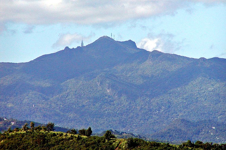
Photo: Stan Shebs, CC BY-SA 3.0.
El Yunque or El Yunque Peak is a mountain located fully within the boundaries of the El Yunque National Forest, part of the U.S. Forest Service, which is the only tropical rainforest under the U.S. Forest Service jurisdiction. El Yunque is situated 1¼ km northwest of Sierra Palm.
Sierra Palm
- Type: Picnic site
- Category: tourism
- Location: Mameyes II, Río Grande, Eastern Coast, Puerto Rico, Caribbean, North America
- View on OpenStreetMap
Latitude
18.30351° or 18° 18′ 13″ northLongitude
-65.7827° or 65° 46′ 58″ westOpen location code
77CP8638+CWOpenStreetMap ID
node 3180696672OpenStreetMap feature
tourism=picnic_site
This page is based on OpenStreetMap, Wikidata, and Wikimedia Commons.
We’d love your help improving our open data sources. Thank you for contributing.
Satellite Map
Discover Sierra Palm from above in high-definition satellite imagery.
Notable Places Nearby
Highlights include Área de Recreo El Yunque and Centro de Visitantes Palo Colorado.
Nearby Places
Explore places such as Yuquiyu Delights and Sierra Palm Visitor Center.
Eastern Coast: Must-Visit Destinations
Delve into Yabucoa, Ceiba, Fajardo, and Humacao.
Curious Picnic Sites to Discover
Uncover intriguing picnic sites from every corner of the globe.
About Mapcarta. Data © OpenStreetMap contributors and available under the Open Database License". Text is available under the CC BY-SA 4.0 license, except for photos, directions, and the map. Photo: Wikimedia, CC0.