The Nag’s Head
The Nag’s Head is a pub in Reading, England which is located on Russell Street. The Nag’s Head is situated nearby to the church The Pavillion, as well as near Central Jamme Mosque (Reading).| Tap on a place to explore it |
Photo: Graham Horn, CC BY-SA 2.0.
- Opening hours:
Sunday—Thursday: noon—11:00 PM
Friday: noon—midnight
Saturday: 11:00 AM—midnight - Email: bar@nagsheadreading.com
- Type: Pub
- Description: pub in Reading, UK
- Also known as: “The Nags Head”
- Address: 5 Russell Street, Reading, RG1 7XD
- Wheelchair access: limited
Places of Interest Nearby
Highlights include Holy Trinity Church, Reading and The Hexagon.
Holy Trinity Church, Reading
Church

Photo: Motacilla, CC BY-SA 3.0.
Holy Trinity Church, also known as the Church of the Holy Trinity, is a Church of England parish church in the town of Reading in the English county of Berkshire.
The Hexagon
Theater building

Photo: Wikimedia, CC BY-SA 2.0.
The Hexagon is a multi-purpose theatre and arts venue in Reading, Berkshire, England. Built in 1977 in the shape of an elongated hexagon, the theatre is operated by Reading Borough Council under the name "Reading Arts and Venues" along with South Street Arts Centre and Reading's concert hall. The Hexagon is situated 1,000 feet east of The Nag’s Head.
Reading Railway Station
Railway station
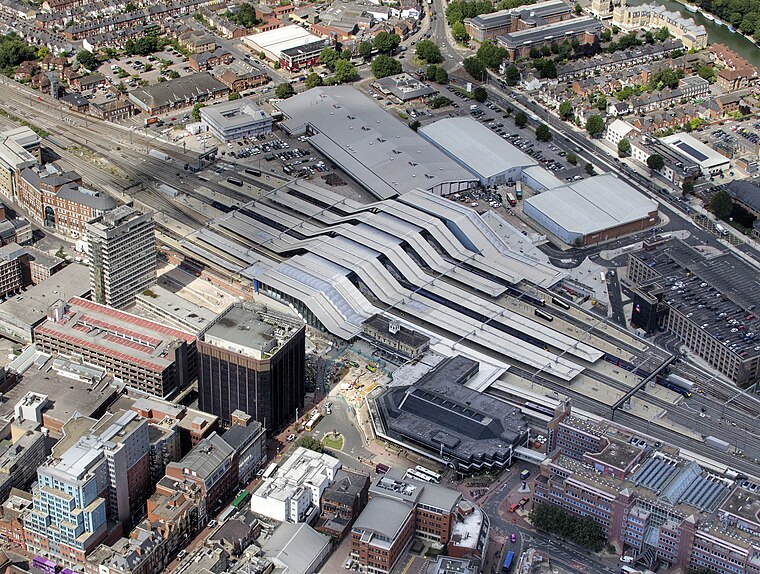
Photo: John Fielding, CC BY 2.0.
Reading railway station is a major transport hub in the town of Reading in Berkshire, England, it is 36 miles west of London Paddington. It is sited on the northern edge of the town centre, near to the main retail and commercial areas and the River Thames. Reading Railway Station is situated 2,800 feet northeast of The Nag’s Head.
Places in the Area
Nearby places include Coley and Coley Park.
Coley
Suburb

Photo: Uli Harder, CC BY-SA 2.0.
Coley is an inner-town district near the centre of the town of Reading, in the English county of Berkshire. It is often referred to as Old Coley, to distinguish it from the adjacent, and much more recent, suburb of Coley Park.
Coley Park
Suburb

Photo: Graham Horn, CC BY-SA 2.0.
Coley Park is a Suburban village to the south of the town of Reading in the English county of Berkshire. It is largely built on the country estate of the same name, surrounding Coley House.
Caversham
Suburb

Photo: Jystyn, Public domain.
Reading is a large, historic town in Berkshire in the South East of England. It is one of the largest towns without city status in the United Kingdom with just under 235,000 inhabitants.
The Nag’s Head
- Location: Reading, England, United Kingdom, Britain and Ireland, Europe
- View on OpenStreetMap
Latitude
51.45456° or 51° 27′ 16″ northLongitude
-0.98225° or 0° 58′ 56″ westOperator
Nags Head Reading LtdOpen location code
9C3XF239+R4OpenStreetMap ID
node 318219889OpenStreetMap feature
amenity=pubOpenStreetMap attribute
wheelchair=limitedWikidata ID
Q114734806
This page is based on OpenStreetMap, Wikidata, and Wikimedia Commons.
We’d love your help improving our open data sources. Thank you for contributing.
Satellite Map
Discover The Nag’s Head from above in high-definition satellite imagery.
Places with the Same Name
Discover other places named “The Nag’s Head”.
Notable Places Nearby
Highlights include The Pavillion and Central Jamme Mosque (Reading).
Nearby Places
Explore places such as Chaps Barbers and Harput Kebab.
England: Must-Visit Destinations
Delve into London, Manchester, Sheffield, and Leeds.
Curious Pubs to Discover
Uncover intriguing pubs from every corner of the globe.
About Mapcarta. Data © OpenStreetMap contributors and available under the Open Database License". Text is available under the CC BY-SA 4.0 license, except for photos, directions, and the map. Photo: Graham Horn, CC BY-SA 2.0.