Paradis eventos
Paradis eventos is a bar in Buenos Aires, Pampas. Paradis eventos is situated nearby to the government office ANSES, as well as near the playground Mega Asterisco.| Tap on a place to explore it |
Places of Interest Nearby
Highlights include Astor Piazzolla International Airport and Mar del Plata railway and bus station.
Astor Piazzolla International Airport
Aerodrome

Photo: Nicolasrnphoto, CC BY-SA 4.0.
Ástor Piazzolla International Airport, also known as Mar del Plata Airport, is an airport serving Mar del Plata, an Atlantic coastal city in the Buenos Aires Province of Argentina. Astor Piazzolla International Airport is situated 3 km north of Paradis eventos.
Mar del Plata railway and bus station
Railway station
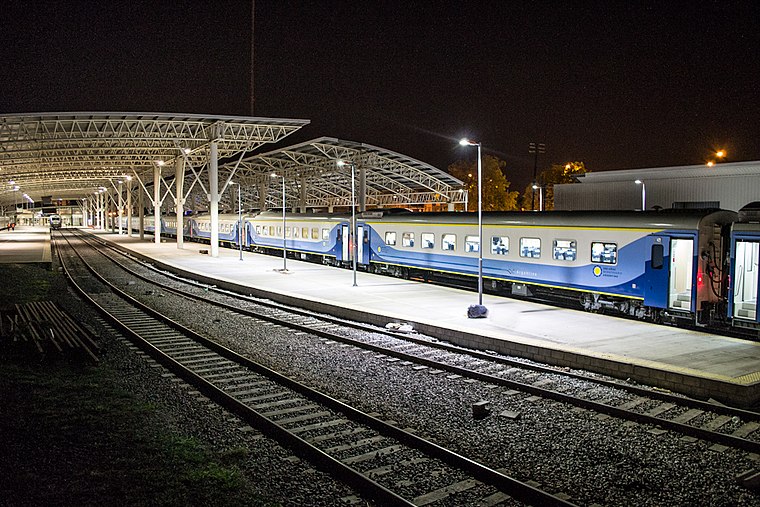
Photo: Wikimedia, CC BY-SA 2.0.
Mar del Plata is a railway and bus terminus in the homonymous city of Buenos Aires Province, Argentina. Opened in 2009 as a bus terminus only, the railway tracks from the old "Norte" station were extended to connect both terminals in 2011 by architect Claudio Luis Lucarelli, adding new platforms to receive trains from Buenos Aires. Mar del Plata railway and bus station is situated 3 km south of Paradis eventos.
Places in the Area
Nearby places include Mar del Plata and Estacion Camet.
Mar del Plata

Photo: DarwIn, CC BY-SA 3.0.
Mar del Plata is on the southwest coast of the Argentinian sea. It is the second most touristic city in the country after Buenos Aires. You can go to Mar del Plata by plane, by bus, by train or by car.
Estacion Camet
Village
Estacion Camet is a railway station and village some 5 km north of Mar del Plata, Buenos Aires province, Argentina. The settlement is commonly referred to as Camet. Estacion Camet is situated 9 km northwest of Paradis eventos.
Paradis eventos
- Type: Bar
- Location: Buenos Aires, Pampas, Argentina, South America
- View on OpenStreetMap
Latitude
-37.95992° or 37° 57′ 36″ southLongitude
-57.56534° or 57° 33′ 55″ westOpen location code
48J42CRM+2VOpenStreetMap ID
node 3188971115OpenStreetMap feature
amenity=bar
This page is based on OpenStreetMap, Wikidata, and Wikimedia Commons.
We’d love your help improving our open data sources. Thank you for contributing.
Satellite Map
Discover Paradis eventos from above in high-definition satellite imagery.
Notable Places Nearby
Highlights include ANSES and Mega Asterisco.
Nearby Places
Explore places such as vidrios and El Mudo.
Buenos Aires: Must-Visit Destinations
Delve into Buenos Aires, La Plata, Mar del Plata, and Centro.
Curious Bars to Discover
Uncover intriguing bars from every corner of the globe.
About Mapcarta. Data © OpenStreetMap contributors and available under the Open Database License". Text is available under the CC BY-SA 4.0 license, except for photos, directions, and the map. Photo: Mbusin, CC BY-SA 4.0.