Seattle Center Totem
The Seattle Center Totem is a 1970 totem pole carved by Duane Pasco, Victor Mowatt, and Earl Muldon, installed at Seattle Center in the U.S. state of Washington.| Tap on a place to explore it |
- Type: Work of art
- Artwork type: sculpture
- Description: 1970 totem pole in Seattle, Washington, U.S
Places of Interest Nearby
Highlights include Space Needle and Climate Pledge Arena.
Space Needle
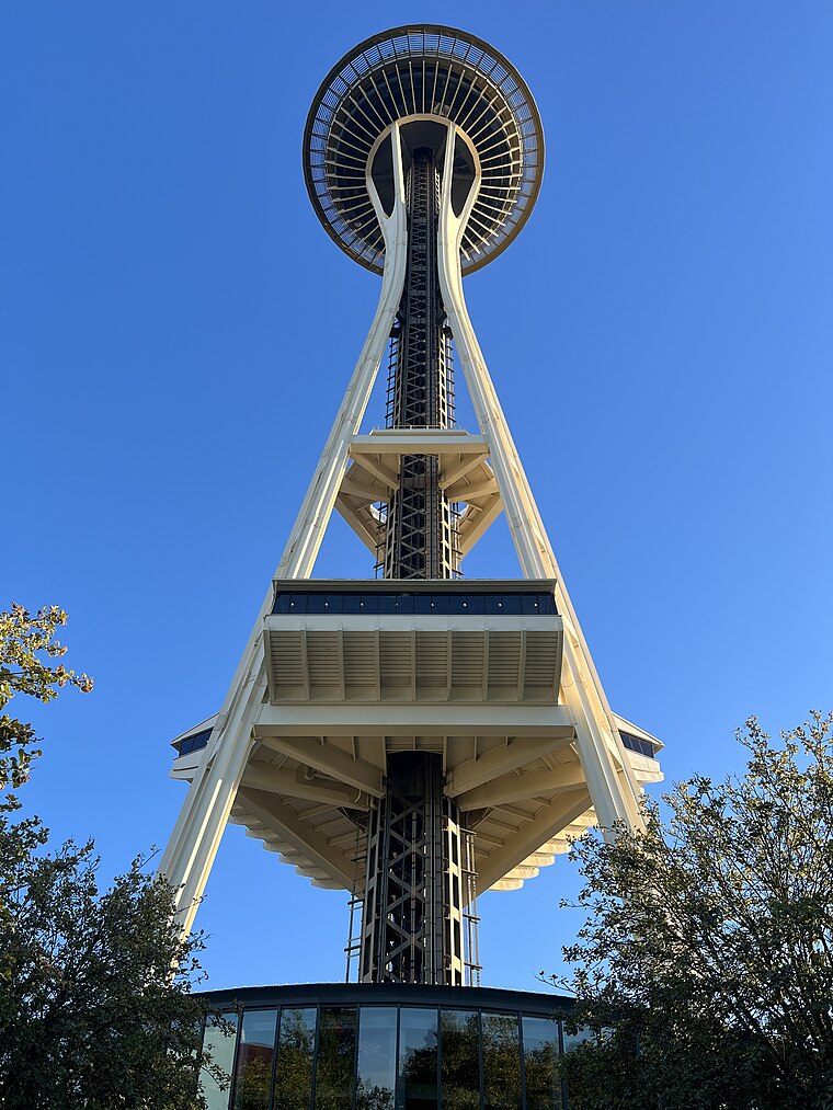
Photo: Another Believer, CC BY-SA 4.0.
The Space Needle is an observation tower in Seattle, Washington, United States. Considered to be an icon of the city, it has been designated a Seattle landmark. Space Needle is situated 530 feet east of Seattle Center Totem.
Climate Pledge Arena
Stadium
 Climate Pledge Arena is a multi-purpose indoor arena in Seattle, Washington, United States. It is located north of downtown Seattle in the 74-acre entertainment complex known as the Seattle Center, the site of the 1962 World's Fair, for which it was originally developed. Climate Pledge Arena is situated 770 feet northwest of Seattle Center Totem.
Seattle Center Monorail
Railway station

Photo: Wikimedia, CC BY-SA 2.5.
The Seattle Center Monorail is an elevated straddle-beam monorail line in Seattle, Washington, United States. The 0.9-mile monorail runs along 5th Avenue between the Seattle Center and Westlake Center in Downtown Seattle, making no intermediate stops. Seattle Center Monorail is situated 440 feet east of Seattle Center Totem.
Places in the Area
Nearby places include Uptown and Queen Anne-South Lake Union.
Uptown
Neighborhood

Photo: Wknight94, CC BY-SA 3.0.
Lower Queen Anne is a neighborhood in northwestern Seattle, Washington, at the base of Queen Anne Hill. While its boundaries are not precise, the toponym usually refers to the shopping, office, and residential districts to the north and west of Seattle Center.
Queen Anne-South Lake Union

Photo: Lumpytrout, CC BY-SA 3.0.
Northwest of Downtown Seattle, Queen Anne is a hilly residential neighborhood with marvelous views of the city's skyline. Magnolia, a wealthy residential neighborhood, sits on a peninsula west of Queen Anne, separated from Queen Anne by Interbay, an unexpected commercial and industrial strip in the valley between the two hilly neighborhoods.
Belltown
Suburb

Photo: Jmabel, CC BY-SA 3.0.
Belltown is the most densely populated neighborhood in Seattle, Washington, United States, located on the city's downtown waterfront on land that was artificially flattened as part of a regrading project.
Seattle Center Totem
- Categories: totem pole and tourism
- Location: King County, Puget Sound, Washington, Pacific Northwest, United States, North America
- View on OpenStreetMap
Latitude
47.62083° or 47° 37′ 15″ northLongitude
-122.35141° or 122° 21′ 5″ westOpen location code
84VVJJCX+8COpenStreetMap ID
node 3211770192OpenStreetMap feature
tourism=artworkOpenStreetMap attribute
artwork_type=sculptureWikidata ID
Q113229944
This page is based on OpenStreetMap, Wikidata, Wikimedia Commons, and Wikipedia.
We’d love your help improving our open data sources. Thank you for contributing.
Satellite Map
Discover Seattle Center Totem from above in high-definition satellite imagery.
Notable Places Nearby
Highlights include Mural Amphitheatre and The Center School.
Nearby Places
Explore places such as Cool Guys Fry Bar and Blue Water Taco Grill.
King County: Must-Visit Destinations
Delve into Seattle, Bellevue, Seattle-Tacoma International Airport, and Capitol Hill-Central District.
Curious Work Of Arts to Discover
Uncover intriguing work of arts from every corner of the globe.
About Mapcarta. Data © OpenStreetMap contributors and available under the Open Database License". Text is available under the CC BY-SA 4.0 license, except for photos, directions, and the map. Description text is based on the Wikipedia page “Seattle Center Totem”. Photo: Lumpytrout, CC BY-SA 3.0.