Merceria Garau
Merceria Garau is a tailor in Oristano, Sardinia which is located on Corso Umberto Primo. Merceria Garau is situated nearby to the government office Comune di Oristano (Ufficio Stato Civile), as well as near Palazzo Arcais.| Tap on a place to explore it |
Places of Interest Nearby
Highlights include Antiquarium arborense and Torre di Mariano II.

Torre di Mariano II

Photo: trolvag, CC BY-SA 3.0.
Torre di Mariano II is situated 170 metres north of Merceria Garau.
Oristano Cathedral
Church
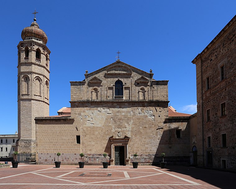 Oristano Cathedral, dedicated to the Assumption of the Virgin Mary, is the Roman Catholic cathedral of Oristano, Sardinia, Italy. It is the seat of the Archbishop of Oristano. Oristano Cathedral is situated 210 metres southwest of Merceria Garau.
Places in the Area
Nearby places include Oristano and Silì.
Oristano
Town

Photo: Tiuliano, CC BY-SA 4.0.
Oristano is the capital and largest city of the Province of Oristano in the central-western part of the autonomous island region of Sardinia in Italy. It is located on the northern part of the Campidano plain.
Silì
Village

Photo: Discanto, CC BY-SA 4.0.
Silì is a village, which is situated 3 km northeast of Merceria Garau.
Santa Giusta
Village

Photo: Carole Raddato, CC BY-SA 2.0.
Santa Giusta is a comune in the Province of Oristano in the Italian region of Sardinia, located about 90 kilometres northwest of Cagliari and about 3 km southeast of Oristano in the Campidano area. Santa Giusta is situated 3½ km southeast of Merceria Garau.
Merceria Garau
Latitude
39.90424° or 39° 54′ 15″ northLongitude
8.5916° or 8° 35′ 30″ eastOpen location code
8FFCWH3R+MJOpenStreetMap ID
node 3275215945OpenStreetMap feature
craft=tailor
This page is based on OpenStreetMap, Wikidata, and Wikimedia Commons.
We’d love your help improving our open data sources. Thank you for contributing.
Satellite Map
Discover Merceria Garau from above in high-definition satellite imagery.
Notable Places Nearby
Highlights include Comune di Oristano (Ufficio Stato Civile) and Palazzo Corrias-Carta.
Nearby Places
Explore places such as CIGL and Pizzeria al taglio Skål.
Oristano: Must-Visit Destinations
Delve into Bosa, Cabras, and Scano di Montiferro.
Curious Places to Discover
Uncover intriguing places from every corner of the globe.
About Mapcarta. Data © OpenStreetMap contributors and available under the Open Database License". Text is available under the CC BY-SA 4.0 license, except for photos, directions, and the map. Photo: Wikimedia, CC0.