Ballyvraghan
Ballyvraghan is a locality in County Wicklow, Leinster. Ballyvraghan is situated nearby to the locality Fauna, as well as near Knockandarragh.| Tap on a place to explore it |
Places of Interest
Highlights include Castleruddery Stone Circle and Sugarloaf.
Castleruddery Stone Circle
Archaeological site

Photo: Digital Eye, CC BY-SA 4.0.
Castleruddery Stone Circle is a recumbent stone circle and National Monument located in County Wicklow, Ireland. Castleruddery Stone Circle is situated 2½ km southwest of Ballyvraghan.
Sugarloaf
Peak

Photo: Jonathan Billinger, CC BY-SA 2.0.
Sugarloaf is a 552 metres peak in west County Wicklow, Ireland that lies on the northern edge of the Glen of Imaal. With a prominence of only 14 metres, it is not listed in any of the recognised categories of mountains in Ireland, and is a subsidiary summit of Lobawn 636 metres, to the north. Sugarloaf is situated 3 km east of Ballyvraghan.
Castleruddery Motte
Archaeological site
Castleruddery Motte is a motte and National Monument located in County Wicklow, Ireland. Castleruddery Motte is situated 3 km southwest of Ballyvraghan.
Places in the Area
Nearby places include Donard and Stratford.
Donard
Village

Photo: Sarah777, Public domain.
Donard is a small village in County Wicklow, Ireland, located at the northern end of the Glen of Imaal, in the western part of the Wicklow Mountains. The village is in a civil parish of the same name.
Stratford
Village
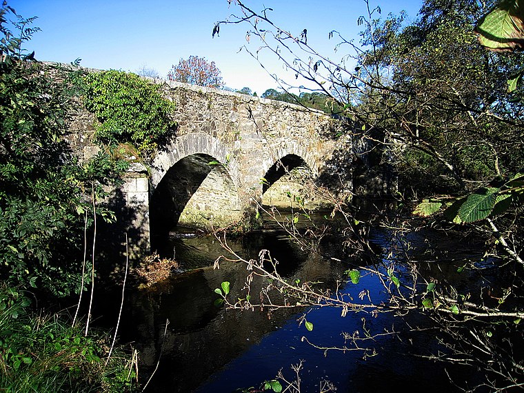
Photo: Sarah777, Public domain.
Stratford-on-Slaney, also known as Stratford or Stratford-upon-Slaney, is a small village on the River Slaney in west County Wicklow in Ireland. It was built by the Earl of Aldborough from 1774. According to the census, the village had a population of 241. Stratford is situated 5 km southwest of Ballyvraghan.
Dunlavin
Village
 Dunlavin is a village in County Wicklow, Ireland, situated about 50 kilometres south-west of Dublin. It is centred on the junction of the R412 and R756 regional roads. Dunlavin is situated 9 km northwest of Ballyvraghan.
Ballyvraghan
- Type: Locality
- Location: County Wicklow, Leinster, East Coast and Midlands, Ireland, Britain and Ireland, Europe
- View on OpenStreetMap
Latitude
53.00671° or 53° 0′ 24″ northLongitude
-6.60615° or 6° 36′ 22″ westOpen location code
9C5M294V+MGOpenStreetMap ID
node 3280992242OpenStreetMap feature
place=locality
This page is based on OpenStreetMap, Wikidata, and Wikimedia Commons.
We’d love your help improving our open data sources. Thank you for contributing.
Satellite Map
Discover Ballyvraghan from above in high-definition satellite imagery.
Localities in the Area
Explore places such as Fauna and Knockandarragh.
Notable Places Nearby
Highlights include Donard Handball Alley and Moat Farm Camping.
County Wicklow: Must-Visit Destinations
Delve into Bray, Wicklow Town, Arklow, and Glendalough.
Curious Localities to Discover
Uncover intriguing localities from every corner of the globe.
About Mapcarta. Data © OpenStreetMap contributors and available under the Open Database License". Text is available under the CC BY-SA 4.0 license, except for photos, directions, and the map. Photo: Wikimedia, CC BY-SA 3.0.