Puits n° 3 ter
Puits n° 3 ter is a memorial in Canton of Bruay-la-Buissière, Arrondissement of Béthune, Hauts-de-France. Puits n° 3 ter is situated nearby to Bruay Communal Cemetery Extension, as well as near the landfill Spoil tip 10.| Tap on a place to explore it |
Places of Interest Nearby
Highlights include Spoil tip 10 and Chapelle Sainte-Barbe de Bruay-la-Buissière.
Spoil tip 10
Landfill

Photo: Jérémy-Günther-Heinz Jähnick, GFDL.
Spoil tip 10 is a landfill, which is situated 460 metres northwest of Puits n° 3 ter.
Chapelle Sainte-Barbe de Bruay-la-Buissière
Church
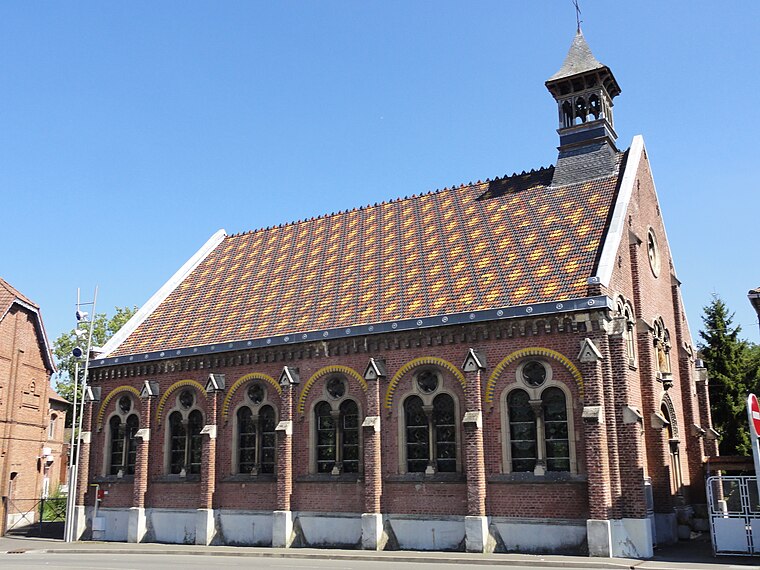
Photo: JÄNNICK Jérémy, Public domain.
Chapelle Sainte-Barbe de Bruay-la-Buissière is a church, which is situated 1½ km east of Puits n° 3 ter.
Gare de Calonne-Ricouart
Railway station

Photo: Alkashouz, CC BY-SA 3.0.
Gare de Calonne-Ricouart is a railway station, which is situated 3 km west of Puits n° 3 ter.
Places in the Area
Nearby places include Bruay-la-Buissière and Labuissière.
Bruay-la-Buissière
Town

Photo: Codepem, CC BY-SA 3.0.
Bruay-la-Buissière is a commune in the Pas-de-Calais department in the Hauts-de-France region in northern France.
Labuissière
Suburb

Photo: Felouch Kotek, CC BY-SA 3.0.
Labuissière is a suburb, which is situated 3 km east of Puits n° 3 ter.
Lillers
Town

Photo: Havang(nl), CC0.
Lillers is a commune in the Pas-de-Calais department in the Hauts-de-France region of France about 15 km northwest of Béthune and 40 km west of Lille. The river Clarence flows through the town. Lillers is situated 9 km northwest of Puits n° 3 ter.
Puits n° 3 ter
- Type: Memorial
- Category: historic site
- Location: Canton of Bruay-la-Buissière, Arrondissement of Béthune, Pas-de-Calais, Hauts-de-France, France, Europe
- View on OpenStreetMap
Latitude
50.48533° or 50° 29′ 7″ northLongitude
2.52545° or 2° 31′ 32″ eastInception
1916Operator
BRGMNetwork
Compagnie des Mines de BruayOpen location code
9F24FGPG+45OpenStreetMap ID
node 3286706564OpenStreetMap feature
historic=memorial
This page is based on OpenStreetMap, Wikidata, and Wikimedia Commons.
We’d love your help improving our open data sources. Thank you for contributing.
Satellite Map
Discover Puits n° 3 ter from above in high-definition satellite imagery.
Places with the Same Name
Discover other places named “Puits n° 3 ter”.
Notable Places Nearby
Highlights include Bruay Communal Cemetery Extension and Mairie Annexe des Terrasses.
Nearby Places
Explore places such as Citroën - S.A.S Coppola and Puits n° 3.
Hauts-de-France: Must-Visit Destinations
Delve into Lille, Dunkirk, Calais, and Amiens.
Curious Memorials to Discover
Uncover intriguing memorials from every corner of the globe.
About Mapcarta. Data © OpenStreetMap contributors and available under the Open Database License". Text is available under the CC BY-SA 4.0 license, except for photos, directions, and the map. Photo: Tony62, CC BY-SA 3.0.