Bruay Communal Cemetery Extension
Bruay Communal Cemetery Extension is a cemetery in Canton of Bruay-la-Buissière, Arrondissement of Béthune, Hauts-de-France. Bruay Communal Cemetery Extension is situated nearby to the town hall Mairie Annexe des Terrasses, as well as near the landfill Spoil tip 10.| Tap on a place to explore it |
- Type: Cemetery
- Description: cemetery located in Pas-de-Calais, in France
- Also known as: “Cimetière de l’Ouest”
Places of Interest Nearby
Highlights include Spoil tip 10 and Chapelle Sainte-Barbe de Bruay-la-Buissière.
Spoil tip 10
Landfill

Photo: Jérémy-Günther-Heinz Jähnick, GFDL.
Spoil tip 10 is a landfill, which is situated 470 metres west of Bruay Communal Cemetery Extension.
Chapelle Sainte-Barbe de Bruay-la-Buissière
Church
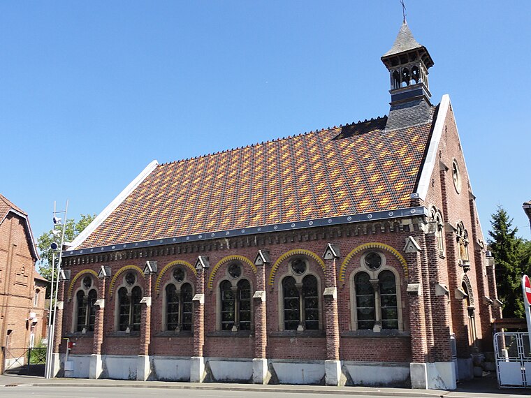
Photo: JÄNNICK Jérémy, Public domain.
Chapelle Sainte-Barbe de Bruay-la-Buissière is a church, which is situated 1½ km east of Bruay Communal Cemetery Extension.
Vis-à-Marles station
Railway stop

Photo: Floflo62, CC BY-SA 3.0.
Vis-à-Marles is a railway station located in the French commune of Marles-les-Mines. The station is served by TER on the line from Saint-Pol-sur-Ternoise to Béthune and Lille-Flandres. Vis-à-Marles station is situated 2 km north of Bruay Communal Cemetery Extension.
Places in the Area
Nearby places include Bruay-la-Buissière and Labuissière.
Bruay-la-Buissière
Town

Photo: Codepem, CC BY-SA 3.0.
Bruay-la-Buissière is a commune in the Pas-de-Calais department in the Hauts-de-France region in northern France.
Labuissière
Suburb

Photo: Felouch Kotek, CC BY-SA 3.0.
Labuissière is a suburb, which is situated 3 km east of Bruay Communal Cemetery Extension.
Lillers
Town

Photo: Havang(nl), CC0.
Lillers is a commune in the Pas-de-Calais department in the Hauts-de-France region of France about 15 km northwest of Béthune and 40 km west of Lille. The river Clarence flows through the town. Lillers is situated 9 km northwest of Bruay Communal Cemetery Extension.
Bruay Communal Cemetery Extension
Latitude
50.48747° or 50° 29′ 15″ northLongitude
2.52621° or 2° 31′ 34″ eastOpen location code
9F24FGPG+XFOpenStreetMap ID
way 89049227OpenStreetMap feature
landuse=cemeteryWikidata ID
Q2337594
This page is based on OpenStreetMap, Wikidata, and Wikimedia Commons.
We’d love your help improving our open data sources. Thank you for contributing.
Satellite Map
Discover Bruay Communal Cemetery Extension from above in high-definition satellite imagery.
In Other Languages
From Dutch to French—“Bruay Communal Cemetery Extension” goes by many names.
- Dutch: “Bruay Communal Cemetery Extension”
- French: “cimetière communal de Bruay, extension”
- French: “cimetière de Bruay-la-Buissière (rue Paul Daguercar)”
- French: “cimetière de l’ouest de Bruay-la-Buissière”
- French: “Cimetière de l’ouest de Bruay-la-Buissière”
- French: “cimetière du n° 3 de Bruay-la-Buissière”
Notable Places Nearby
Highlights include Mairie Annexe des Terrasses and Stade des Agaches.
Nearby Places
Explore places such as Cimetière and Cimetière.
Hauts-de-France: Must-Visit Destinations
Delve into Lille, Dunkirk, Calais, and Amiens.
Curious Cemeteries to Discover
Uncover intriguing cemeteries from every corner of the globe.
About Mapcarta. Data © OpenStreetMap contributors and available under the Open Database License". Text is available under the CC BY-SA 4.0 license, except for photos, directions, and the map. Photo: Tony62, CC BY-SA 3.0.