Patatini
Patatini is a fast food restaurant in Silly, Arrondissement of Soignies, Wallonia which is located on Chaussée de Soignies. Patatini is situated nearby to the church Église Saint-Maurice, as well as near the village Hoves.| Tap on a place to explore it |
- Type: Fast food restaurant
- Cuisine: friture
- Address: Chaussée de Soignies 19, Hoves, 7830
Places of Interest Nearby
Highlights include Enghien Gardens and Enghien railway station.
Enghien Gardens
Park

Photo: Romeyn de Hooghe, Public domain.
The Enghien Gardens are a domain of 182 hectares in Enghien or 'Edingen', Wallonia, Belgium, created by the dukes of Arenberg in the 17th and 18th century. Enghien Gardens is situated 2 km north of Patatini.
Enghien railway station
Railway station
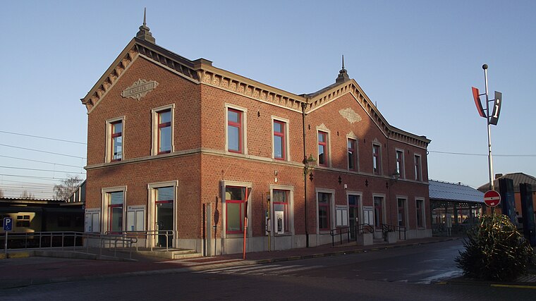
Photo: Smiley.toerist, CC BY-SA 3.0.
Enghien railway station is situated 3½ km north of Patatini.
Saint Martin’s Church
Church

Photo: Jean-Pol GRANDMONT, CC BY 2.5.
Saint Martin’s Church is situated 3 km northwest of Patatini.
Places in the Area
Nearby places include Hoves and Marcq.

Marcq
Village

Photo: Wikimedia, CC BY-SA 3.0.
Marcq is a village, which is situated 3 km northwest of Patatini.
Enghien
Town

Photo: Jean-Pol GRANDMONT, CC BY 3.0.
Enghien is a city and municipality of Wallonia located in the province of Hainaut, Belgium. On 1 January 2006, Enghien had a total population of 11,980. Enghien is situated 3 km north of Patatini.
Patatini
- Categories: food and restaurant
- Location: Silly, Arrondissement of Soignies, Hainaut, Wallonia, Belgium, Benelux, Europe
- View on OpenStreetMap
Latitude
50.66724° or 50° 40′ 2″ northLongitude
4.03715° or 4° 2′ 14″ eastOpen location code
9F26M28P+VVOpenStreetMap ID
node 3296938861OpenStreetMap feature
amenity=fast_foodOpenStreetMap attribute
cuisine=friture
This page is based on OpenStreetMap, Wikidata, and Wikimedia Commons.
We’d love your help improving our open data sources. Thank you for contributing.
Satellite Map
Discover Patatini from above in high-definition satellite imagery.
Notable Places Nearby
Highlights include Église Saint-Maurice and Motte féodale.
Nearby Places
Explore places such as Hoves Cité Beau Site and L’oubli.
Hainaut: Must-Visit Destinations
Delve into Charleroi, Mons, Tournai, and La Louvière.
Curious Fast Food Restaurants to Discover
Uncover intriguing fast food restaurants from every corner of the globe.
About Mapcarta. Data © OpenStreetMap contributors and available under the Open Database License". Text is available under the CC BY-SA 4.0 license, except for photos, directions, and the map. Photo: Jean-Pol GRANDMONT, CC BY-SA 3.0.