Gaststätte Peffelberg
Gaststätte Peffelberg is a beer garden in Idar-Oberstein, Birkenfeld, Rhineland-Palatinate. Gaststätte Peffelberg is situated nearby to the place of worship Kirchengemeinde Idar Bez. Tiefenstein, as well as near the church Dietrich - Bonhöfer - Haus.| Tap on a place to explore it |
Places of Interest Nearby
Highlights include Stadion Im Haag and Wildenburger Kopf.
Stadion Im Haag
Pitch
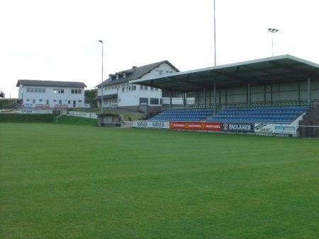
Photo: Rkal, CC BY-SA 3.0.
Stadion Im Haag is a pitch, which is situated 2 km southeast of Gaststätte Peffelberg.
Wildenburger Kopf
Peak

Photo: Wikimedia, CC BY-SA 3.0.
The Wildenburger Kopf is a mountain that reaches a height of 664 m above sea level in the Idar Forest in the Hunsrück mountains near the village of Kempfeld. Wildenburger Kopf is situated 3½ km north of Gaststätte Peffelberg.
Deutsches Edelsteinmuseum
Museum

Photo: Wikimedia, CC BY-SA 3.0.
Deutsches Edelsteinmuseum is situated 4 km southeast of Gaststätte Peffelberg.
Places in the Area
Nearby places include Hettenrodt and Kirschweiler.
Hettenrodt
Village
 Hettenrodt is an Ortsgemeinde – a municipality belonging to a Verbandsgemeinde, a kind of collective municipality – in the Birkenfeld district in Rhineland-Palatinate, Germany. It belongs to the Verbandsgemeinde Herrstein-Rhaunen, whose seat is in Herrstein.
Kirschweiler
Village
Kirschweiler is an Ortsgemeinde – a municipality belonging to a Verbandsgemeinde, a kind of collective municipality – in the Birkenfeld district in Rhineland-Palatinate, Germany. It belongs to the Verbandsgemeinde Herrstein-Rhaunen, whose seat is in Herrstein.
Veitsrodt
Village

Photo: AK-Bino, CC BY-SA 4.0.
Veitsrodt is an Ortsgemeinde – a municipality belonging to a Verbandsgemeinde, a kind of collective municipality – in the Birkenfeld district in Rhineland-Palatinate, Germany. It belongs to the Verbandsgemeinde Herrstein-Rhaunen, whose seat is in Herrstein. Veitsrodt is situated 2½ km northeast of Gaststätte Peffelberg.
Gaststätte Peffelberg
- Type: Beer garden
- Address: Idar-Oberstein, 55743
- Location: Idar-Oberstein, Birkenfeld, Hunsrück, Rhineland-Palatinate, Germany, Central Europe, Europe
- View on OpenStreetMap
Latitude
49.7461° or 49° 44′ 46″ northLongitude
7.26914° or 7° 16′ 9″ eastOpen location code
8FX9P7W9+CMOpenStreetMap ID
node 332618689OpenStreetMap feature
amenity=biergarten
This page is based on OpenStreetMap, Wikidata, and Wikimedia Commons.
We’d love your help improving our open data sources. Thank you for contributing.
Satellite Map
Discover Gaststätte Peffelberg from above in high-definition satellite imagery.
Notable Places Nearby
Highlights include Kirchengemeinde Idar Bez. Tiefenstein and Dietrich - Bonhöfer - Haus.
Nearby Places
Explore places such as Hasenhaus and Cerman.
Rhineland-Palatinate: Must-Visit Destinations
Delve into Mainz, Trier, Koblenz, and Worms.
Curious Beer Gardens to Discover
Uncover intriguing beer gardens from every corner of the globe.
About Mapcarta. Data © OpenStreetMap contributors and available under the Open Database License". Text is available under the CC BY-SA 4.0 license, except for photos, directions, and the map. Photo: W. Bulach, CC BY-SA 4.0.