Crossrah
Crossrah is a locality in County Cavan, Ulster. Crossrah is situated nearby to the locality Corwin, as well as near Aghnaskeagh.| Tap on a place to explore it |
Places of Interest
Highlights include St Bride’s Church of Ireland.

Places in the Area
Nearby places include Mountnugent and Oldcastle.
Mountnugent
Village

Photo: Kieran Campbell, CC BY-SA 2.0.
Mountnugent, or Mount Nugent, historically known as Dalysbridge, is a village and townland in southern County Cavan, Ireland. The village is on the R154 regional road, at a river crossing near Lough Sheelin.
Oldcastle
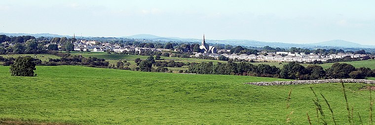
Photo: Sarah777, Public domain.
Oldcastle is a town in County Meath in central Ireland, with a population in 2022 of 1400. The reason to visit is the collection of prehistoric tombs at Loughcrew Cairns, which are as fine as those at better-known Newgrange but even older, and without the tourist hordes.
Ballyjamesduff
Town

Photo: HENRY CLARK, CC BY-SA 2.0.
Ballyjamesduff is a town in County Cavan, Ireland. A former market town, it was the winner of the 1966 and 1967 Irish Tidy Towns Competition. Ballyjamesduff is situated 8 km northeast of Crossrah.
Crossrah
- Type: Locality
- Location: County Cavan, Ulster, Northwest Ireland and Lakelands, Ireland, Britain and Ireland, Europe
- View on OpenStreetMap
Latitude
53.79919° or 53° 47′ 57″ northLongitude
-7.25867° or 7° 15′ 31″ westOpen location code
9C5JQPXR+MGOpenStreetMap ID
node 3346338900OpenStreetMap feature
place=locality
This page is based on OpenStreetMap, Wikidata, and Wikimedia Commons.
We’d love your help improving our open data sources. Thank you for contributing.
Satellite Map
Discover Crossrah from above in high-definition satellite imagery.
Localities in the Area
Explore places such as Corwin and Aghnaskeagh.
Notable Places Nearby
Highlights include The Rock and Crossrah Bog.
County Cavan: Must-Visit Destinations
Delve into Cavan Town, Belturbet, Virginia, and Bailieborough.
Curious Localities to Discover
Uncover intriguing localities from every corner of the globe.
About Mapcarta. Data © OpenStreetMap contributors and available under the Open Database License". Text is available under the CC BY-SA 4.0 license, except for photos, directions, and the map. Photo: Wikimedia, CC0.