Folderpunt
Folderpunt is a tourism office in Aa en Hunze, Drenthe. Folderpunt is situated nearby to the playground Waterspeelplaats, as well as near the theater building Boerderij Kamps.| Tap on a place to explore it |
Places of Interest Nearby
Highlights include D16 and Drents Museum.
D16
Archaeological site

Photo: Gouwenaar, Public domain.
D16 is an archaeological site, which is situated 1½ km northeast of Folderpunt.
Drents Museum
Museum

Photo: CrazyPhunk, CC BY-SA 3.0.
The Drents Museum is an art and history museum in Assen, Drenthe, the Netherlands. Opened in 1854, it has a collection of prehistoric artifacts, applied art and visual art, as well as temporary exhibitions. In 2023, it had 179,345 visitors. Drents Museum is situated 3 km west of Folderpunt.
Assen railway station
Railway station
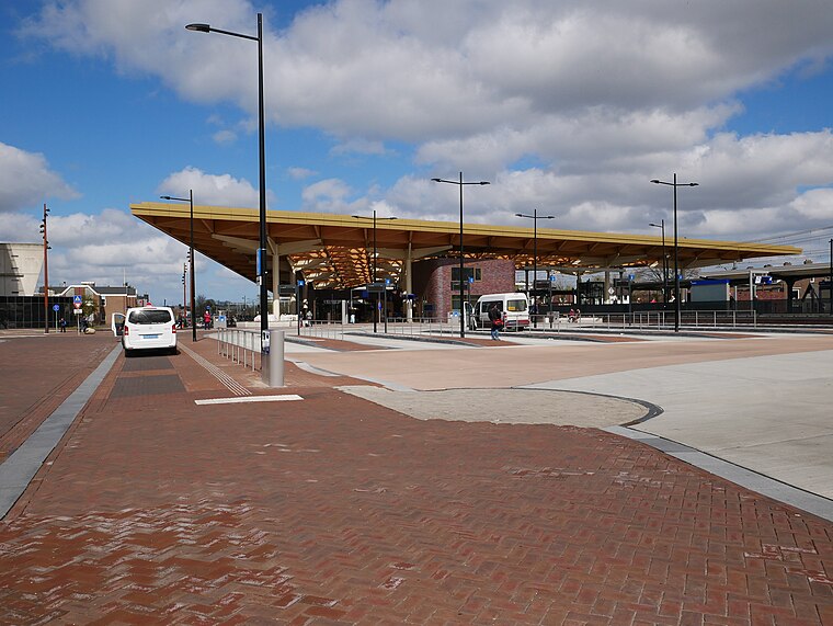
Photo: Fantaglobe11, CC BY-SA 4.0.
Assen is a railway station located in Assen, Netherlands. The station was opened on 1 May 1870 and is located on the Meppel–Groningen railway. The station is operated by Nederlandse Spoorwegen. Assen railway station is situated 2½ km west of Folderpunt.
Places in the Area
Nearby places include Schieven and Balloo.
Schieven
Hamlet
Schieven is a hamlet in the Netherlands and is part of the Assen municipality in Drenthe. Schieven is a statistical entity with Anreep, however the postal authority have placed it under Assen.
Balloo
Village
Balloo is a small village in the northeast Netherlands. It is located in the municipality of Aa en Hunze, Drenthe, about 5 km east of Assen. The village has a population of around 150.
Anreep
Hamlet
Anreep is a hamlet in the Netherlands and is part of the Assen municipality in Drenthe. Anreep is a statistical entity with Schieven, however the postal authority have placed it under Assen.
Folderpunt
- Type: Tourism office
- Wheelchair access: yes
- Categories: information and tourism
- Location: Aa en Hunze, Drenthe, Northern Netherlands, Netherlands, Benelux, Europe
- View on OpenStreetMap
Latitude
52.98891° or 52° 59′ 20″ northLongitude
6.61018° or 6° 36′ 37″ eastOpen location code
9F48XJQ6+H3OpenStreetMap ID
node 3373128817OpenStreetMap feature
tourism=informationOpenStreetMap attribute
wheelchair=yes
This page is based on OpenStreetMap, Wikidata, and Wikimedia Commons.
We’d love your help improving our open data sources. Thank you for contributing.
Satellite Map
Discover Folderpunt from above in high-definition satellite imagery.
Notable Places Nearby
Highlights include Waterspeelplaats and Boerderij Kamps.
Nearby Places
Explore places such as Bistro Aa and Diabolo.
Drenthe: Must-Visit Destinations
Delve into Assen, Hoogeveen, Meppel, and Coevorden.
Curious Tourism Offices to Discover
Uncover intriguing tourism offices from every corner of the globe.
About Mapcarta. Data © OpenStreetMap contributors and available under the Open Database License". Text is available under the CC BY-SA 4.0 license, except for photos, directions, and the map. Photo: Hardscarf, CC0.