Maison de Quartier des Épinettes
Maison de Quartier des Épinettes is a community center in Issy-les-Moulineaux, Arrondissement of Boulogne-Billancourt, Île-de-France. Maison de Quartier des Épinettes is situated nearby to Esplanade des Constellations (ex-Forum), as well as near the post office Relais La Poste Epinettes.| Tap on a place to explore it |
Places of Interest Nearby
Highlights include Issy station and Hôpital d’instruction des armées Percy.
Issy station
Railway station

Photo: Wikimedia, CC BY-SA 2.5.
Issy station is a station in Paris's express suburban rail system, the RER. It is situated in Issy-les-Moulineaux, in the département of Hauts-de-Seine. Issy station is situated 220 metres north of Maison de Quartier des Épinettes.
Hôpital d’instruction des armées Percy
Hospital
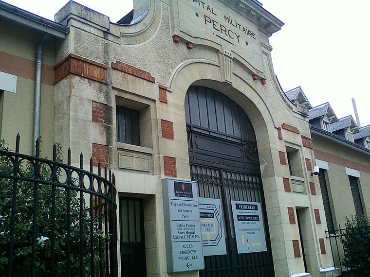
Photo: Strologoff, CC BY-SA 3.0.
The Hôpital d'instruction des armées Percy or HIA Percy is a military hospital in Clamart, near Paris, France. It is managed by the Service de santé des armées and provides health services to both military and civilian patients. Hôpital d’instruction des armées Percy is situated 500 metres southwest of Maison de Quartier des Épinettes.
Cemetery of Issy-les-Moulineaux
Cemetery

Photo: Yelti, CC BY-SA 3.0.
Cemetery of Issy-les-Moulineaux is situated 290 metres southeast of Maison de Quartier des Épinettes.
Places in the Area
Nearby places include Issy-les-Moulineaux and Meudon.
Issy-les-Moulineaux
Town

Photo: Guilhem Vellut, CC BY 2.0.
Issy-les-Moulineaux is a commune in the southwestern suburban area of Paris, France, lying on the left bank of the river Seine. Its citizens are called Isséens in French.
Meudon
Town

Photo: Jean-Christophe BENOIST, CC BY 3.0.
Meudon is a French commune located in the Hauts-de-Seine department in the Île-de-France region, on the left bank of the Seine. It is located 9.1 km from the center of Paris.
Clamart
Town

Photo: Wikimedia, CC BY-SA 3.0.
Clamart is a commune in the southwestern suburbs of Paris, France. It is located 8.7 km from the centre of Paris. The town is divided into two parts, separated by a forest: bas Clamart, the historical centre, and petit Clamart with urbanization developed in the 1960s replacing pea fields.
Maison de Quartier des Épinettes
Latitude
48.81792° or 48° 49′ 5″ northLongitude
2.25957° or 2° 15′ 35″ eastOperator
CLAVIMOpen location code
8FW4R795+5ROpenStreetMap ID
node 3383304137OpenStreetMap feature
amenity=community_centre
This page is based on OpenStreetMap, Wikidata, and Wikimedia Commons.
We’d love your help improving our open data sources. Thank you for contributing.
Satellite Map
Discover Maison de Quartier des Épinettes from above in high-definition satellite imagery.
Places with the Same Name
Discover other places named “Maison de Quartier des Épinettes”.
Notable Places Nearby
Highlights include Esplanade des Constellations (ex-Forum) and Relais La Poste Epinettes.
Nearby Places
Explore places such as Pharmacie des Épinettes and Médecin.
Île-de-France: Must-Visit Destinations
Delve into Paris, Versailles, Boulogne-Billancourt, and Paris Charles de Gaulle Airport.
Curious Community Centers to Discover
Uncover intriguing community centers from every corner of the globe.
About Mapcarta. Data © OpenStreetMap contributors and available under the Open Database License". Text is available under the CC BY-SA 4.0 license, except for photos, directions, and the map. Photo: Clicsouris, CC BY-SA 2.5.