Romanby Road CCTV
Romanby Road CCTV is a level crossing in Romanby, Hambleton, England. Romanby Road CCTV is situated nearby to the railway station Ticket Office, as well as near Church of St James the Great.| Tap on a place to explore it |
Places of Interest Nearby
Highlights include Northallerton railway station and Church of St James the Great.
Northallerton railway station
Railway station
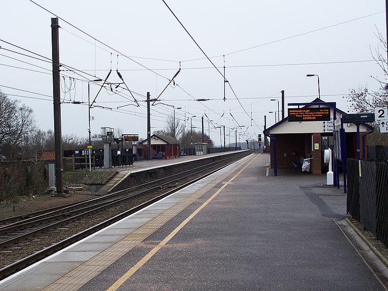
Photo: Adambro, CC BY-SA 2.5.
Northallerton railway station is on the East Coast Main Line serving the market town of Northallerton in North Yorkshire, England. It is between Thirsk to the south and Darlington to the north. Northallerton railway station is situated 940 feet southeast of Romanby Road CCTV.
Church of St James the Great
Church

Photo: Gordon Hatton, CC BY-SA 2.0.
Church of St James the Great is situated 880 feet southwest of Romanby Road CCTV.
Romanby War Memorial Clock Tower
Memorial

Photo: David Cowling, CC BY-SA 2.0.
Romanby War Memorial Clock Tower is situated 930 feet southwest of Romanby Road CCTV.
Places in the Area
Nearby places include Northallerton and Ainderby Steeple.
Northallerton

Photo: JohnArmagh, CC BY-SA 3.0.
Northallerton is the county town of North Yorkshire in England. With a population in 2011 of 16,832, it has light industry, local government employment, a large hospital, Friarage, and the Leeming RAF base.
Ainderby Steeple
Village

Photo: Oliver Dixon, CC BY-SA 2.0.
Ainderby Steeple is a village and civil parish in North Yorkshire, England. Ainderby Steeple is situated on the A684 approximately 2.6 miles south-west of the county town of Northallerton, and to the immediate east of Morton-on-Swale. Ainderby Steeple is situated 2 miles west of Romanby Road CCTV.
Brompton
Village

Photo: RichTea, CC BY-SA 2.0.
Brompton is a village and civil parish in the unitary area and county of North Yorkshire, England, about 1.6 miles north of Northallerton. The village was near the site of a battle between English and Scots armies and was the location of mills producing linen goods from the 18th century onward. Brompton is situated 2 miles northeast of Romanby Road CCTV.
Romanby Road CCTV
- Type: Level crossing
- Category: transportation
- Location: Romanby, Hambleton, North Yorkshire, Yorkshire, England, United Kingdom, Britain and Ireland, Europe
- View on OpenStreetMap
Latitude
54.33453° or 54° 20′ 4″ northLongitude
-1.44404° or 1° 26′ 39″ westOpen location code
9C6W8HM4+R9OpenStreetMap ID
node 340168483OpenStreetMap feature
railway=level_crossing
This page is based on OpenStreetMap, Wikidata, and Wikimedia Commons.
We’d love your help improving our open data sources. Thank you for contributing.
Satellite Map
Discover Romanby Road CCTV from above in high-definition satellite imagery.
Notable Places Nearby
Highlights include Ticket Office and Kingdom Hall.
Nearby Places
Explore places such as Romanby Road CCTV and Romanby Gate.
North Yorkshire: Must-Visit Destinations
Delve into York, Middlesbrough, Harrogate, and Ripon.
Curious Level Crossings to Discover
Uncover intriguing level crossings from every corner of the globe.
About Mapcarta. Data © OpenStreetMap contributors and available under the Open Database License". Text is available under the CC BY-SA 4.0 license, except for photos, directions, and the map. Photo: Michael Bryan, CC BY 2.0.