Conde y Palpa
Conde y Palpa is a bus stop in Colegiales, Comuna 13, Buenos Aires, Buenos Aires. Conde y Palpa is situated nearby to the hospital Sanatorio Colegiales, as well as near the church Iglesia Cristiana Evangélica.| Tap on a place to explore it |
Places of Interest Nearby
Highlights include Colegiales train station and Federico Lacroze railway station.
Colegiales train station
Railway station

Photo: Roberto Fiadone, CC BY-SA 3.0.
Colegiales train station is a railway station, which is situated 540 metres northeast of Conde y Palpa.
Federico Lacroze railway station
Railway station

Photo: Aleksandrs Timofejev…, CC BY 3.0.
Federico Lacroze railway station is a passenger railway station in Buenos Aires, Argentina. The station is located in the city's outlying barrio of Chacarita in a predominantly residential area. Federico Lacroze railway station is situated 1¼ km south of Conde y Palpa.
Simik Photographic Museum
Museum
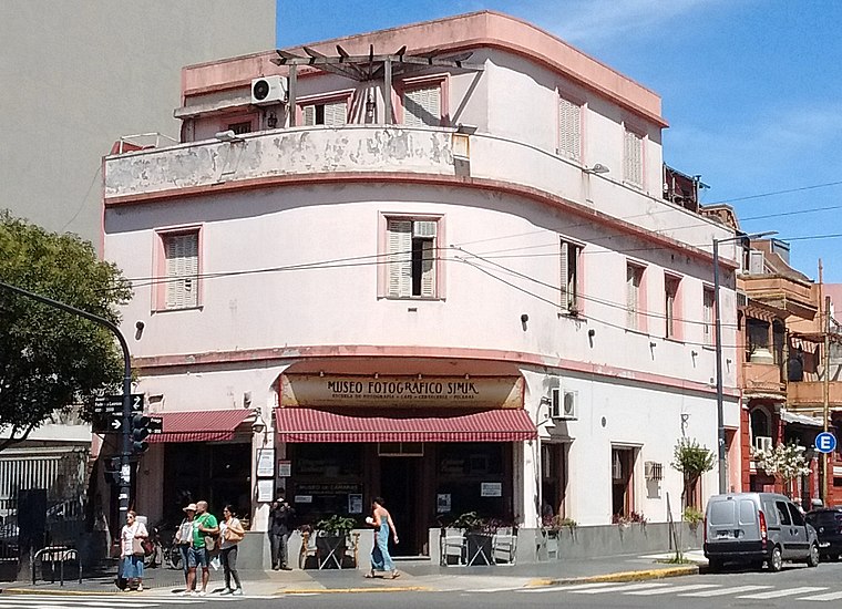
Photo: Roberto Fiadone, CC BY-SA 3.0.
Simik Photographic Museum is situated 1 km south of Conde y Palpa.
Places in the Area
Nearby places include Casa Colectiva Parque Los Andes and Outskirts.
Casa Colectiva Parque Los Andes
Neighborhood

Photo: Roberto Fiadone, CC BY-SA 4.0.
Casa Colectiva Parque Los Andes is a neighborhood.
Outskirts

Photo: china, CC BY-SA 2.0.
Belgrano is a northern barrio or neighborhood of Buenos Aires, Argentina. It is made up of middle and upper class people. Belgrano has three distinct areas: the main one that is made up of apartment buildings, Belgrano "R" which is a leafy suburb area with English architecture, and Buenos Aires' Chinatown.
Barrio Chino
Neighborhood

Photo: Wikimedia, CC BY 2.5 ar.
Buenos Aires' Chinatown, locally known as Barrio Chino, is a largely commercial section about five blocks long in the barrio of Belgrano, Buenos Aires.
Conde y Palpa
- Type: Bus stop
- Category: transportation
- Location: Colegiales, Comuna 13, Buenos Aires, Buenos Aires, Pampas, Argentina, South America
- View on OpenStreetMap
Latitude
-34.5769° or 34° 34′ 37″ southLongitude
-58.45172° or 58° 27′ 6″ westOpen location code
48Q3CGFX+68OpenStreetMap ID
node 3413786566OpenStreetMap feature
highway=bus_stopOpenStreetMap feature
public_transport=platform
This page is based on OpenStreetMap, Wikidata, and Wikimedia Commons.
We’d love your help improving our open data sources. Thank you for contributing.
Satellite Map
Discover Conde y Palpa from above in high-definition satellite imagery.
Notable Places Nearby
Highlights include Sanatorio Colegiales and Escuela de Enfermería del Sanatorio Colegiales.
Nearby Places
Explore places such as Conde y Palpa and Rock & Pop 95.9.
Buenos Aires: Must-Visit Destinations
Delve into Centro, Palermo & Recoleta, La Boca & Barracas, and Outskirts.
Curious Bus Stops to Discover
Uncover intriguing bus stops from every corner of the globe.
About Mapcarta. Data © OpenStreetMap contributors and available under the Open Database License". Text is available under the CC BY-SA 4.0 license, except for photos, directions, and the map. Photo: Moemoemoe, CC0.