Trent Valley View
Trent Valley View is in Thrumpton, Rushcliffe, England. Trent Valley View is situated nearby to the forest Round Spinney, as well as near the nature reserve Gotham Sandbanks.| Tap on a place to explore it |
Places of Interest Nearby
Highlights include Gotham Library and St Lawrence’s Church, Gotham.
Gotham Library
Library

Photo: Alan Murray-Rust, CC BY-SA 2.0.
Gotham Library is situated 2,900 feet east of Trent Valley View.
St Lawrence’s Church, Gotham
Church
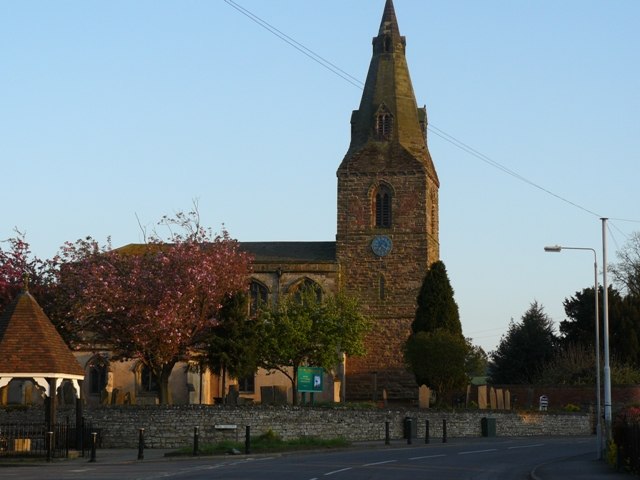
Photo: Andy Jamieson, CC BY-SA 2.0.
St. Lawrence's Church, Gotham is a Grade I listed parish church in the Church of England in Gotham, Nottinghamshire. It is part of an informal grouping of five churches that are known collectively as "The 453 Churches" as they straddle the A453. St Lawrence’s Church, Gotham is situated 3,800 feet southeast of Trent Valley View.
All Saints Church
Church

Photo: Tim Heaton, CC BY-SA 2.0.
All Saints’ Church, Thrumpton is a Grade II* listed parish church in the Church of England in Thrumpton, Nottinghamshire. A stone font in the churchyard is Grade II listed. All Saints Church is situated 1¼ miles west of Trent Valley View.
Places in the Area
Nearby places include Gotham and Thrumpton.
Gotham
Village
 Gotham is a village and civil parish in Nottinghamshire, England, measured at 1,563 in the 2011 census, and marginally increasing to 1,567 at the 2021 census.
Thrumpton
Village

Photo: Chris J Dixon, CC BY-SA 2.0.
Thrumpton is a village and civil parish in Nottinghamshire, England. At the time of the 2001 census it had a population of 152, increasing to 165 at the 2011 census, and 178 at the 2021 census.
Fairham
Suburb

Photo: Aethonatic, CC0.
Fairham is an under construction suburb in the borough of Rushcliffe in Nottinghamshire. It is located directly to the south of Clifton and roughly 4.5 miles south-west of Nottingham's city centre and is set to be approximately 245.2 hectares in area. Fairham is situated 1½ miles northeast of Trent Valley View.
Trent Valley View
- Type: Sign
- Categories: information and tourism
- Location: Thrumpton, Rushcliffe, Nottinghamshire, East Midlands, England, United Kingdom, Britain and Ireland, Europe
- View on OpenStreetMap
Latitude
52.87254° or 52° 52′ 21″ northLongitude
-1.21739° or 1° 13′ 3″ westOpen location code
9C4WVQFM+22OpenStreetMap ID
node 3414277006OpenStreetMap feature
tourism=information
This page is based on OpenStreetMap, Wikidata, and Wikimedia Commons.
We’d love your help improving our open data sources. Thank you for contributing.
Satellite Map
Discover Trent Valley View from above in high-definition satellite imagery.
Notable Places Nearby
Highlights include Round Spinney and Gotham Sandbanks.
Nearby Places
Explore places such as Morley’s Barn Farm and Old School House.
Nottinghamshire: Must-Visit Destinations
Delve into Nottingham, Mansfield, Newark-on-Trent, and Worksop.
Curious Places to Discover
Uncover intriguing places from every corner of the globe.
About Mapcarta. Data © OpenStreetMap contributors and available under the Open Database License". Text is available under the CC BY-SA 4.0 license, except for photos, directions, and the map. Photo: Wikimedia, CC0.