Philadelphia 30th Street Station
Philadelphia 30th Street Station is a railway stop in Philadelphia, Philadelphia Region, Pennsylvania. Philadelphia 30th Street Station is situated nearby to the work of art The Spirit of Transportation, as well as near the railway station William H. Gray III 30th Street Station.| Tap on a place to explore it |
Places of Interest Nearby
Highlights include 30th Street Station and Philadelphia Museum of Art.
30th Street Station
Railway station

Photo: Smallbones, Public domain.
30th Street Station, officially William H. Gray III 30th Street Station, is a major intermodal transit station in Philadelphia, Pennsylvania, United States.
Philadelphia Museum of Art
Museum
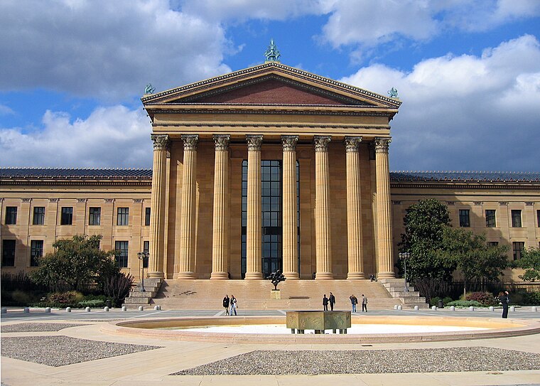
Photo: Wikimedia, Public domain.
The Philadelphia Museum of Art is an art museum originally chartered in 1876 for the Centennial Exposition in Philadelphia. The main museum building was completed in 1928 on Fairmount, a hill located at the northwest end of the Benjamin Franklin Parkway at Eakins Oval. Philadelphia Museum of Art is situated 3,300 feet north of Philadelphia 30th Street Station.
United States Post Office-Main Branch
Government office

Photo: Smallbones, Public domain.
The former United States Post Office-Main Branch is a historic post office building that is located in the University City neighborhood of Philadelphia. United States Post Office-Main Branch is situated 970 feet south of Philadelphia 30th Street Station.
Places in the Area
Nearby places include Center City West and Powelton Village.
Center City West

Photo: Lucius Kwok, CC BY-SA 2.0.
Philadelphia's Center City West is the downtown area west of City Hall. It contains downtown's upscale shopping district, the financial district, and the museum district along the Benjamin Franklin Parkway, culminating in the Philadelphia Art Museum and Fairmount Park.
Powelton Village
Neighborhood

Photo: MikeJones133, Public domain.
Powelton Village is a neighborhood in the West Philadelphia section of Philadelphia, Pennsylvania. It consists of mostly Victorian and twin style homes.
University City
Neighborhood

Photo: Veldtkitty40, CC BY-SA 3.0.
University City is the easternmost portion of West Philadelphia, encompassing several Philadelphia universities. It is situated directly across the Schuylkill River from Center City.
Philadelphia 30th Street Station
- Type: Railway stop
- Categories: transport stop and transportation
- Location: Philadelphia, Philadelphia, Philadelphia Region, Pennsylvania, Mid-Atlantic, United States, North America
- View on OpenStreetMap
Latitude
39.95642° or 39° 57′ 23″ northLongitude
-75.18155° or 75° 10′ 54″ westNetwork
SEPTAOpen location code
87F6XR49+H9OpenStreetMap ID
node 3426208025OpenStreetMap feature
public_transport=stop_positionOpenStreetMap feature
railway=stop
This page is based on OpenStreetMap, Wikidata, and Wikimedia Commons.
We’d love your help improving our open data sources. Thank you for contributing.
Satellite Map
Discover Philadelphia 30th Street Station from above in high-definition satellite imagery.
Places with the Same Name
Discover other places named “Philadelphia 30th Street Station”.
Notable Places Nearby
Highlights include The Spirit of Transportation and William H. Gray III 30th Street Station.
Nearby Places
Explore places such as Philadelphia 30th Street Station and Pret A Manger.
Philadelphia: Must-Visit Destinations
Delve into Philadelphia International Airport, Old City, West Philadelphia, and Center City West.
Curious Railway Stops to Discover
Uncover intriguing railway stops from every corner of the globe.
About Mapcarta. Data © OpenStreetMap contributors and available under the Open Database License". Text is available under the CC BY-SA 4.0 license, except for photos, directions, and the map. Photo: Dave Z, CC BY 2.0.