Excel Cars
Excel Cars is a taxicab stand in Birmingham, England. Excel Cars is situated nearby to St Barnabas’ Church, Balsall Heath, as well as near Clifton Primary School.| Tap on a place to explore it |
Places of Interest Nearby
Highlights include St Barnabas’ Church, Balsall Heath and Nelson Mandela Primary School.
St Barnabas’ Church, Balsall Heath
Church
St Barnabas' is a parish church in the Church of England in Balsall Heath, Birmingham, England.
Nelson Mandela Primary School
School
Birmingham is a city and metropolitan borough in the metropolitan county of West Midlands, within the wider West Midlands region, in England. It is the largest local authority district in England by population and the second-largest city in Britain – commonly referred to as the second city of the United Kingdom – with a population of 1.2 million people in the city proper in 2024. Nelson Mandela Primary School is situated 830 feet northeast of Excel Cars.
Public Library and Baths, Balsall Heath
Library

Photo: Oosoom, CC BY-SA 3.0.
The Public Library and Baths on Moseley Road, Balsall Heath, form one of many pairings of baths and libraries in Birmingham, England. The library was opened in 1895, with the baths following in 1907. Public Library and Baths, Balsall Heath is situated 2,200 feet northwest of Excel Cars.
Places in the Area
Nearby places include Balti Triangle and Balsall Heath.
Balti Triangle
Locality
A balti or bāltī gosht is a type of curry within the United Kingdom served in a thin, pressed-steel wok called a balti bowl. Balti curries are cooked quickly using vegetable oil rather than ghee, over high heat in the manner of a stir-fry, and any meat is used off the bone.
Balsall Heath
Village

Photo: Oosoom, CC BY-SA 3.0.
Balsall Heath is an inner-city area of Birmingham, West Midlands, England. It has a diverse cultural mix of people and is the location of the Balti Triangle.
Sparkhill
Suburb
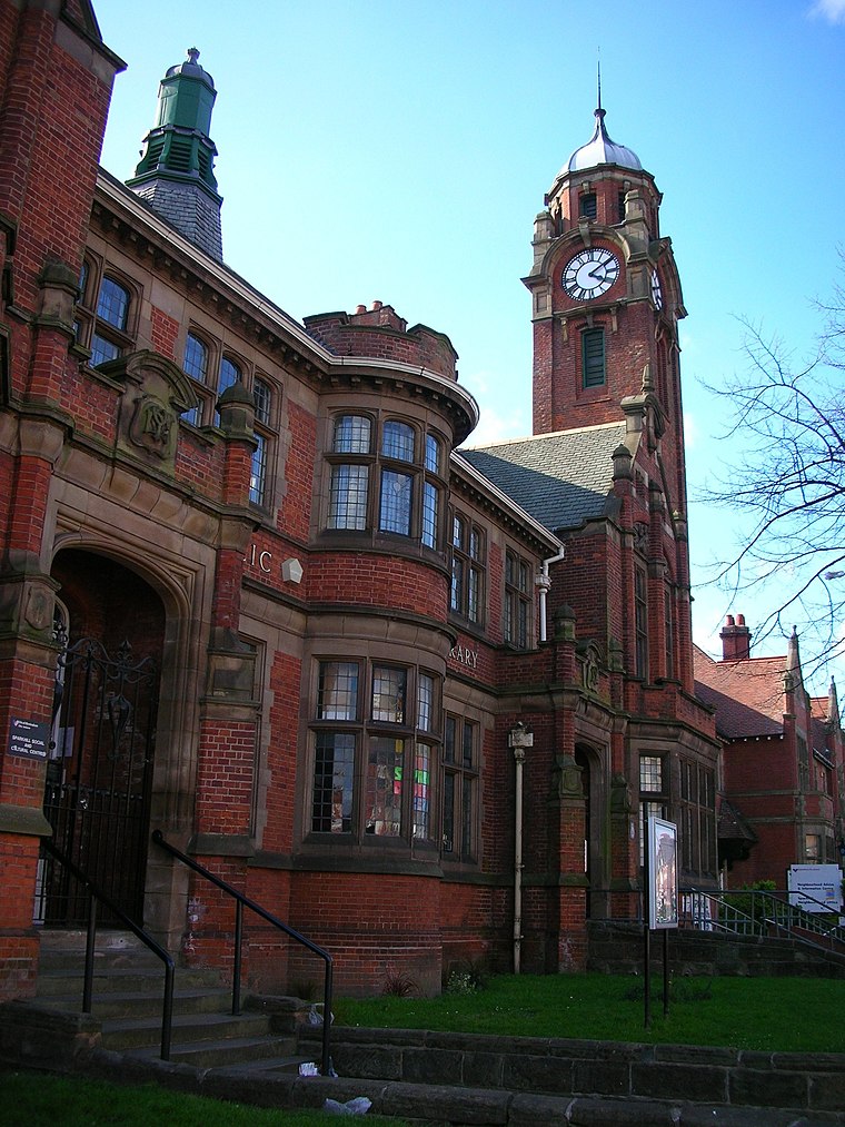
Photo: Oosoom, CC BY-SA 3.0.
Sparkhill is an inner-city area of Birmingham, England, situated between Springfield, Hall Green and Sparkbrook. Historically part of Worcestershire, Sparkhill once existed as a rural area with its main industry being agriculture until the 1880s.
Excel Cars
- Type: Taxicab stand
- Category: transportation
- Location: Birmingham, England, United Kingdom, Britain and Ireland, Europe
- View on OpenStreetMap
Latitude
52.45483° or 52° 27′ 17″ northLongitude
-1.87726° or 1° 52′ 38″ westOpen location code
9C4WF43F+W3OpenStreetMap ID
node 3460994710OpenStreetMap feature
amenity=taxi
This page is based on OpenStreetMap, Wikidata, and Wikimedia Commons.
We’d love your help improving our open data sources. Thank you for contributing.
Satellite Map
Discover Excel Cars from above in high-definition satellite imagery.
Notable Places Nearby
Highlights include Clifton Primary School and Fountain of Knowledge Islamic Centre.
Nearby Places
Explore places such as Hillbrook Dental Care and Desire.
England: Must-Visit Destinations
Delve into London, Manchester, Sheffield, and Leeds.
Curious Taxicab Stands to Discover
Uncover intriguing taxicab stands from every corner of the globe.
About Mapcarta. Data © OpenStreetMap contributors and available under the Open Database License". Text is available under the CC BY-SA 4.0 license, except for photos, directions, and the map. Photo: sidibousaid, CC BY 2.0.