Lion’s Market
Lion’s Market is a convenience store in Stanislaus County, San Joaquin Valley, California. Lion’s Market is situated nearby to 7th Street Bridge, as well as near Pentecostal Church.| Tap on a place to explore it |
Places of Interest Nearby
Highlights include Modesto City-County Airport and Modesto Junior College East Campus.
Modesto City-County Airport
Aerodrome
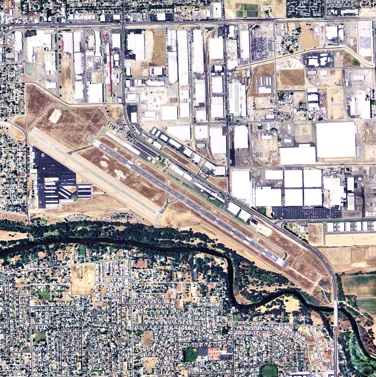
Photo: USGS, Public domain.
Modesto City–County Airport is two miles southeast of Modesto in Stanislaus County, California, United States. Modesto City-County Airport is situated 2 miles east of Lion’s Market.
Modesto Junior College East Campus
College

Photo: Ryanx7, CC BY-SA 4.0.
Modesto Junior College is a public community college in Modesto, California. It is part of Yosemite Community College District along with Columbia College. Modesto Junior College East Campus is situated 2 miles northwest of Lion’s Market.
Central Catholic High School
School
Central Catholic High School is a private, Roman Catholic, co-educational, college-preparatory school in Modesto, California, United States. It was established in 1966 and is part of the Roman Catholic Diocese of Stockton. Central Catholic High School is situated 2 miles west of Lion’s Market.
Places in the Area
Nearby places include Bystrom and Shackelford.
Bystrom
Neighborhood
Bystrom is a census-designated place in Stanislaus County, California, United States. The population was 3,957 at the 2020 census, down from 4,008 at the 2010 census. It is part of the Modesto Metropolitan Statistical Area.
Shackelford
Neighborhood
Shackelford is a southern neighbourhood of the city of Modesto in Stanislaus County, California, United States, which was officially annexed on June 1, 2012.
Modesto

Photo: Imokurnotok, Public domain.
Modesto is the county seat of and the largest city in Stanislaus County, California, United States. With a population of 218,069 according to 2022 U.S. Census Bureau estimates, it is the 19th-most populous city in California.
Lion’s Market
- Type: Convenience store
- Categories: shop and food
- Location: Stanislaus County, San Joaquin Valley, California, United States, North America
- View on OpenStreetMap
Latitude
37.62516° or 37° 37′ 31″ northLongitude
-120.99352° or 120° 59′ 37″ westOpen location code
849XJ2G4+3HOpenStreetMap ID
node 3466886631OpenStreetMap feature
shop=convenience
This page is based on OpenStreetMap, Wikidata, and Wikimedia Commons.
We’d love your help improving our open data sources. Thank you for contributing.
Satellite Map
Discover Lion’s Market from above in high-definition satellite imagery.
Notable Places Nearby
Highlights include 7th Street Bridge and Pentecostal Church.
Nearby Places
Explore places such as Caltrans Modesto Electrical Maintenance Station and Tuolumne River at Modesto.
Stanislaus County: Must-Visit Destinations
Delve into Modesto, Turlock, Oakdale, and Patterson.
Curious Convenience Stores to Discover
Uncover intriguing convenience stores from every corner of the globe.
About Mapcarta. Data © OpenStreetMap contributors and available under the Open Database License". Text is available under the CC BY-SA 4.0 license, except for photos, directions, and the map. Photo: Wikimedia, CC0.