Stroudbridge Farmhouse
Stroudbridge Farmhouse is a farm in Stroud, East Hampshire, England. Stroudbridge Farmhouse is situated nearby to the forest Furzefield Copse, as well as near Langrish Primary School.| Tap on a place to explore it |
- Type: Farm
- Description: farmhouse in Stroud, East Hampshire, England, UK
- Also known as: “Stroudbridge Farm”
Places of Interest Nearby
Highlights include Petersfield railway station and Butser Hill.
Petersfield railway station
Railway station
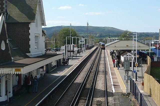
Photo: Graham Horn, CC BY-SA 2.0.
Petersfield railway station serves the market town of Petersfield, Hampshire, England. It is on the Portsmouth Direct line, 54 miles 71 chains down the line from London Waterloo via Woking. Petersfield railway station is situated 1½ miles east of Stroudbridge Farmhouse.
Butser Hill
Peak

Photo: StephenDawson, CC BY-SA 2.0.
Butser Hill is a hill and nature reserve in Hampshire, England. South-west of Petersfield, it is a 239.7-hectare biological and geological Site of Special Scientific Interest. Butser Hill is situated 1½ miles south of Stroudbridge Farmhouse.
Church of St John the Evangelist
Church

Photo: Hassocks5489, CC0.
Church of St John the Evangelist is situated 1¼ miles northwest of Stroudbridge Farmhouse.
Places in the Area
Nearby places include Weston and Ramsdean.
Weston
Hamlet
Weston is a hamlet in the East Hampshire district of Hampshire, England. It is in the civil parish of Buriton. It is 1.4 miles southwest of Petersfield. The nearest railway station is Petersfield, 1.4 miles northeast of the village.
Ramsdean
Hamlet

Photo: Stuart Logan, CC BY-SA 2.0.
Ramsdean is a village in the East Hampshire district of Hampshire, England. It is 2.7 miles west of Petersfield. The nearest railway station is Petersfield, 2.7 miles east of the village.
Petersfield

Photo: Bashereyre, CC BY-SA 3.0.
Petersfield is a market town and civil parish in the East Hampshire district of Hampshire, England. It is 15 miles north of Portsmouth. The town has its own railway station on the Portsmouth Direct line, the mainline rail link connecting Portsmouth and London.
Stroudbridge Farmhouse
- Categories: farmhouse, locality, and agriculture
- Location: Stroud, East Hampshire, Hampshire, South East England, England, United Kingdom, Britain and Ireland, Europe
- View on OpenStreetMap
Latitude
51.00157° or 51° 0′ 6″ northLongitude
-0.97455° or 0° 58′ 28″ westOpen location code
9C3X222G+J5OpenStreetMap ID
node 3468418092OpenStreetMap feature
place=farmWikidata ID
Q26385884
This page is based on OpenStreetMap, Wikidata, and Wikimedia Commons.
We’d love your help improving our open data sources. Thank you for contributing.
Satellite Map
Discover Stroudbridge Farmhouse from above in high-definition satellite imagery.
Notable Places Nearby
Highlights include Furzefield Copse and Langrish Primary School.
Nearby Places
Explore places such as Stroudbridge Cottage and The Seven Stars.
Hampshire: Must-Visit Destinations
Delve into Southampton, Portsmouth, Winchester, and Farnborough.
Curious Farms to Discover
Uncover intriguing farms from every corner of the globe.
About Mapcarta. Data © OpenStreetMap contributors and available under the Open Database License". Text is available under the CC BY-SA 4.0 license, except for photos, directions, and the map. Photo: TomHab, CC BY-SA 3.0.