Foto Maurer
Foto Maurer is a photographer in Kaiserslautern, Palatinate, Rhineland-Palatinate which is located on Marktstraße. Foto Maurer is situated nearby to the restaurant Zum Spinnrädl, as well as near Marktplatz.| Tap on a place to explore it |
- Opening hours:
Monday, Tuesday, Thursday, and Friday: 10:00 AM—6:00 PM
Wednesday and Saturday: 10:00 AM—2:00 PM - Type: Photographer
- Address: Marktstraße 24, Kaiserslautern, 67655
- Wheelchair access: no
Places of Interest Nearby
Highlights include Stiftskirche and Central-Kino.

Central-Kino
Movie theater
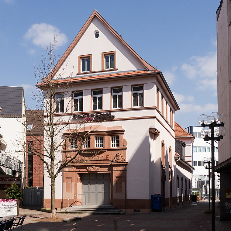
Photo: J folz, CC BY-SA 3.0.
Central-Kino is a movie theater, which is situated 100 metres south of Foto Maurer.

Places in the Area
Nearby places include Betzenberg and Siedlung Bahnheim.
Betzenberg
Suburb
The Betzenberg is a 285-metre-high hill in the German city of Kaiserslautern. It rises about 50 metres above the city and gives its name to the quarter in which it stands. It was well known because it also gave its name to what is now the Fritz Walter Stadium.
Siedlung Bahnheim
Suburb

Photo: J folz, CC BY-SA 3.0.
Siedlung Bahnheim is a suburb, which is situated 3 km west of Foto Maurer.
Morlautern
Suburb

Photo: Muck50, CC BY-SA 4.0.
Morlautern is a suburb, which is situated 3 km north of Foto Maurer.
Foto Maurer
- Categories: shop, workshop, and photo shop
- Location: Kaiserslautern, Palatinate, Rhineland-Palatinate, Germany, Central Europe, Europe
- View on OpenStreetMap
Latitude
49.44463° or 49° 26′ 41″ northLongitude
7.77058° or 7° 46′ 14″ eastOpen location code
8FX9CQVC+V6OpenStreetMap ID
node 3488363593OpenStreetMap feature
craft=photographerOpenStreetMap feature
shop=photoOpenStreetMap attribute
wheelchair=no
This page is based on OpenStreetMap, Wikidata, and Wikimedia Commons.
We’d love your help improving our open data sources. Thank you for contributing.
Satellite Map
Discover Foto Maurer from above in high-definition satellite imagery.
Notable Places Nearby
Highlights include Marktbrunnen and Marktplatz.
Nearby Places
Explore places such as La Casa del Habano and Cafe Extrablatt.
Palatinate: Must-Visit Destinations
Delve into Ludwigshafen, Speyer, Pirmasens, and Landau in der Pfalz.
Curious Photographers to Discover
Uncover intriguing photographers from every corner of the globe.
About Mapcarta. Data © OpenStreetMap contributors and available under the Open Database License". Text is available under the CC BY-SA 4.0 license, except for photos, directions, and the map. Photo: Leiflive, CC BY-SA 4.0.