Farran
Farran is a locality in County Cork, Munster. Farran is situated nearby to the locality Burke’s Bridge, as well as near Maulrour.| Tap on a place to explore it |
Places in the Area
Nearby places include Ballinascarty and Ahiohill.
Ballinascarty
Village
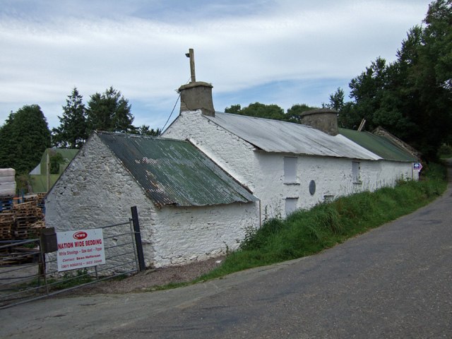
Photo: Mike Searle, CC BY-SA 2.0.
Ballinascarty, also known as Ballinascarthy, is a village in County Cork, Ireland. Ballinascarty is situated 4½ km southwest of Farran.
Ahiohill
Hamlet
Ahiohill is a small village in County Cork, Ireland. The historical spelling for the area, Aghyohil, is reflected in the names of two local townlands, Aghyohil Beg and Aghyohil More. Ahiohill is situated 6 km west of Farran.
Timoleague
Village

Photo: Wikimedia, CC BY-SA 3.0.
Timoleague is a village in the eastern division of Carbery East in County Cork, Ireland. It is located along Ireland's southern coast between Kinsale and Clonakilty, on the estuary of the Argideen River. Timoleague is situated 6 km southeast of Farran.
Farran
- Type: Locality
- Location: County Cork, Munster, Southwest Ireland, Ireland, Britain and Ireland, Europe
- View on OpenStreetMap
Latitude
51.69363° or 51° 41′ 37″ northLongitude
-8.80713° or 8° 48′ 26″ westOpen location code
9C3HM5VV+F4OpenStreetMap ID
node 3528778983OpenStreetMap feature
place=locality
This page is based on OpenStreetMap, Wikidata, and Wikimedia Commons.
We’d love your help improving our open data sources. Thank you for contributing.
Satellite Map
Discover Farran from above in high-definition satellite imagery.
Places with the Same Name
Discover other places named “Farran”.
Localities in the Area
Explore places such as Burke’s Bridge and Maulrour.
Notable Places Nearby
Highlights include Skeaf Wood and Monteen Wood.
County Cork: Must-Visit Destinations
Delve into Cork, Cobh, Kinsale, and Mallow.
Curious Localities to Discover
Uncover intriguing localities from every corner of the globe.
About Mapcarta. Data © OpenStreetMap contributors and available under the Open Database License". Text is available under the CC BY-SA 4.0 license, except for photos, directions, and the map. Photo: Wikimedia, CC BY-SA 3.0.