Broughton Bakery
Broughton Bakery is a bakery in Boston Spa, Leeds, England. Broughton Bakery is situated nearby to the playground Joon, as well as near Boston Spa Library.| Tap on a place to explore it |
Places of Interest Nearby
Highlights include Boston Spa Library and St Mary the Virgin Church, Boston Spa.

St Mary the Virgin Church, Boston Spa
Church

Photo: Mtaylor848, CC BY-SA 3.0.
The Church of St Mary the Virgin in Boston Spa, West Yorkshire, England is an active Anglican parish church in the archdeaconry of York and the Diocese of York. It is a Grade II listed building. St Mary the Virgin Church, Boston Spa is situated 550 feet northwest of Broughton Bakery.
Thorp Arch Bridge
Bridge

Photo: Gordon Hatton, CC BY-SA 2.0.
Thorp Arch Bridge is a stone arch bridge opened in 1770 across the River Wharfe linking the West Yorkshire villages of Boston Spa on the southbank and Thorp Arch on the north. Thorp Arch Bridge is situated 860 feet northeast of Broughton Bakery.
Places in the Area
Nearby places include Boston Spa and Thorp Arch.
Boston Spa
Village
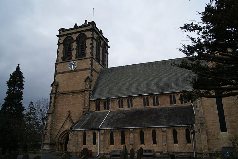
Photo: Mtaylor848, CC BY-SA 3.0.
Boston Spa is a village and civil parish in the Leeds Metropolitan District in West Yorkshire, England. Situated 3 miles south of Wetherby, Boston Spa is on the south bank of the River Wharfe across from Thorp Arch.
Thorp Arch
Village

Photo: Wikimedia, CC BY-SA 2.0.
Thorp Arch is a village and civil parish near Wetherby in the City of Leeds metropolitan borough of West Yorkshire, England.
Clifford
Hamlet

Photo: Mtaylor848, CC BY-SA 3.0.
Clifford is a village and civil parish in West Yorkshire, England. The population of the civil parish at the 2011 Census was 1,662. The village is 3 miles south of Wetherby. Many of the older buildings are built of magnesian limestone.
Broughton Bakery
- Type: Bakery
- Categories: shop and food
- Location: Boston Spa, Leeds, England, United Kingdom, Britain and Ireland, Europe
- View on OpenStreetMap
Latitude
53.90518° or 53° 54′ 19″ northLongitude
-1.34752° or 1° 20′ 51″ westOpen location code
9C5WWM42+3XOpenStreetMap ID
node 3557381806OpenStreetMap feature
shop=bakery
This page is based on OpenStreetMap, Wikidata, and Wikimedia Commons.
We’d love your help improving our open data sources. Thank you for contributing.
Satellite Map
Discover Broughton Bakery from above in high-definition satellite imagery.
Notable Places Nearby
Highlights include Joon and Boston Spa Post Office.
Nearby Places
Explore places such as L’Aquila Restaurant and Harts Coffee House.
England: Must-Visit Destinations
Delve into London, Manchester, Sheffield, and Leeds.
Curious Bakeries to Discover
Uncover intriguing bakeries from every corner of the globe.
About Mapcarta. Data © OpenStreetMap contributors and available under the Open Database License". Text is available under the CC BY-SA 4.0 license, except for photos, directions, and the map. Photo: sidibousaid, CC BY 2.0.