Pen-Cefn-Arda
Pen-Cefn-Arda is a bus stop in Gorseinon, Swansea, Wales. Pen-Cefn-Arda is situated nearby to Penyrheol Cemetery, as well as near the sports venue Penyrheol Leisure Centre.| Tap on a place to explore it |
Places of Interest Nearby
Highlights include Gorseinon Hospital and Penyrheol Comprehensive School.
Gorseinon Hospital
Hospital

Photo: Jaggery, CC BY-SA 2.0.
Gorseinon Hospital is a rehabilitation hospital in Gorseinon, Wales. It is managed by Swansea Bay University Health Board. Gorseinon Hospital is situated 2,800 feet southwest of Pen-Cefn-Arda.
Penyrheol Comprehensive School
School
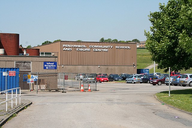
Photo: Martin Bodman, CC BY-SA 2.0.
Penyrheol Comprehensive School is a secondary school in Gorseinon, Swansea, Wales. Penyrheol Comprehensive School is situated 1,600 feet south of Pen-Cefn-Arda.
Gorseinon Library
Library

Photo: Jaggery, CC BY-SA 2.0.
Gorseinon Library is situated 4,000 feet south of Pen-Cefn-Arda.
Places in the Area
Nearby places include Penyrheol and Gorseinon.
Penyrheol
Suburb
Penyrheol is a suburban district of Swansea, Wales falling within the Penyrheol ward. Penyrheol is located about 7 miles north west of Swansea city centre in northwest Gorseinon.
Gorseinon
Town

Photo: Ruth Sharville, CC BY-SA 2.0.
Gorseinon is a town within the City and County of Swansea, Wales, near the Loughor estuary. It was a small village until the late 19th century, when it grew around the coal mining and tinplate industries.
Kingsbridge
Suburb

Photo: Jaggery, CC BY-SA 2.0.
Kingsbridge, is a village in the City and County of Swansea, Wales falling within the Kingsbridge ward. It covers the south east of the town of Gorseinon.
Pen-Cefn-Arda
- Type: Bus stop
- Category: transportation
- Location: Gorseinon, Swansea, Wales, United Kingdom, Britain and Ireland, Europe
- View on OpenStreetMap
Latitude
51.67898° or 51° 40′ 44″ northLongitude
-4.04247° or 4° 2′ 33″ westOpen location code
9C3QMXH5+H2OpenStreetMap ID
node 3601552675OpenStreetMap feature
highway=bus_stopOpenStreetMap feature
public_transport=platform
This page is based on OpenStreetMap, Wikidata, and Wikimedia Commons.
We’d love your help improving our open data sources. Thank you for contributing.
Satellite Map
Discover Pen-Cefn-Arda from above in high-definition satellite imagery.
Notable Places Nearby
Highlights include Penyrheol Cemetery and Penyrheol Leisure Centre.
Nearby Places
Explore places such as Pen-Cefn-Arda and Sunningdale Drive NE.
Wales: Must-Visit Destinations
Delve into Cardiff, Newport, Llanfairpwllgwyngyll, and Bangor.
Curious Bus Stops to Discover
Uncover intriguing bus stops from every corner of the globe.
About Mapcarta. Data © OpenStreetMap contributors and available under the Open Database License". Text is available under the CC BY-SA 4.0 license, except for photos, directions, and the map. Photo: Andrew Evans, CC BY 2.0.