Lower Mill Farm
Lower Mill Farm is a farm in Lychpit, Basingstoke and Deane, England. Lower Mill Farm is situated nearby to the community center Old Basing Village Hall, as well as near the public building Parish Office.| Tap on a place to explore it |
Places of Interest Nearby
Highlights include The Mill Field, Hampshire and The Bolton Arms Public House.
The Mill Field, Hampshire
Nature reserve
The Mill Field is a 11.7-hectare Local Nature Reserve in Basingstoke in Hampshire. It is owned by Basingstoke and Deane Borough Council and managed by the Mill Field Conservation Group and Basingstoke and Deane Borough Council.
The Bolton Arms Public House
Pub

Photo: Dr Neil Clifton, CC BY-SA 2.0.
The Bolton Arms Public House is situated 1,300 feet southwest of Lower Mill Farm.
Basing House
Ruins

Photo: Sandy B, CC BY-SA 2.0.
Basing House was a Tudor palace and castle in the village of Old Basing in the English county of Hampshire. It once rivalled Hampton Court Palace in its size and opulence. Basing House is situated 3,900 feet southwest of Lower Mill Farm.
Places in the Area
Nearby places include Old Basing and Andwell.
Old Basing
Village
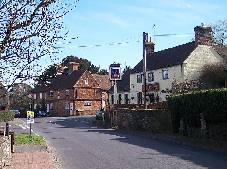
Photo: Wikimedia, Public domain.
Old Basing is a village in Hampshire, England, just east of Basingstoke. It was called Basengum in the Anglo-Saxon Chronicle and Basinges in the Domesday Book.
Andwell
Hamlet

Photo: Fleur Piercy, CC BY-SA 2.0.
Andwell is a village and former civil parish, now in the parish of Mapledurwell and Up Nately, in the Basingstoke and Deane district of Hampshire, England.
Mapledurwell
Village

Photo: Lewis Hulbert, CC BY-SA 4.0.
Mapledurwell is a village and former civil parish, now in the parish of Mapledurwell and Up Nately, in the Basingstoke and Deane district, in the county of Hampshire, England. It is located south east of Basingstoke. In 1931 the parish had a population of 182. Mapledurwell is situated 2 miles southeast of Lower Mill Farm.
Lower Mill Farm
- Type: Farm
- Category: agriculture
- Location: Lychpit, Basingstoke and Deane, Hampshire, South East England, England, United Kingdom, Britain and Ireland, Europe
- View on OpenStreetMap
Latitude
51.27846° or 51° 16′ 43″ northLongitude
-1.04235° or 1° 2′ 33″ westOpen location code
9C3W7XH5+93OpenStreetMap ID
node 3633372615OpenStreetMap feature
landuse=farm
This page is based on OpenStreetMap, Wikidata, and Wikimedia Commons.
We’d love your help improving our open data sources. Thank you for contributing.
Satellite Map
Discover Lower Mill Farm from above in high-definition satellite imagery.
Places with the Same Name
Discover other places named “Lower Mill Farm”.
Notable Places Nearby
Highlights include Old Basing Village Hall and Parish Office.
Nearby Places
Explore places such as Old Basing Village Hall and Bartons Lane Scrap Yard.
Hampshire: Must-Visit Destinations
Delve into Southampton, Portsmouth, Winchester, and Farnborough.
Curious Farms to Discover
Uncover intriguing farms from every corner of the globe.
About Mapcarta. Data © OpenStreetMap contributors and available under the Open Database License". Text is available under the CC BY-SA 4.0 license, except for photos, directions, and the map. Photo: TomHab, CC BY-SA 3.0.