Ancien station de relais US/OTAN
Ancien station de relais US/OTAN is a tower in Flobecq, Arrondissement of Ath, Wallonia. Ancien station de relais US/OTAN is situated nearby to the peak 139, as well as near the nature reserve Livierenbos.| Tap on a place to explore it |
Places of Interest Nearby
Highlights include Livierenbos and Chapelle Sainte-Anne de Flobecq-Bois.

Chapelle Sainte-Anne de Flobecq-Bois
Church

Photo: Grentidez, CC BY-SA 4.0.
Chapelle Sainte-Anne de Flobecq-Bois is a church, which is situated 1 km southwest of Ancien station de relais US/OTAN.

Places in the Area
Nearby places include La Houppe and Opbrakel.
La Houppe
Hamlet
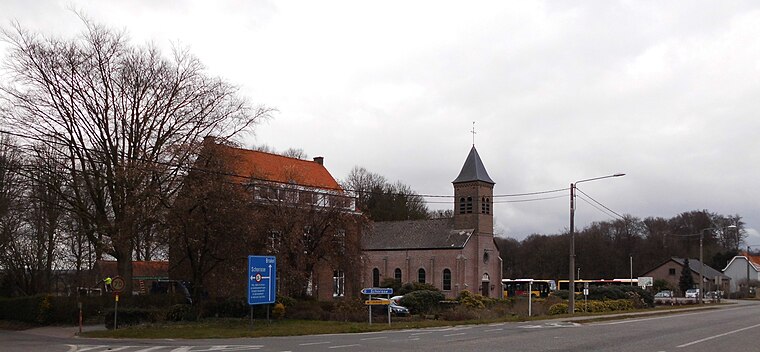
Photo: Spotter2, CC BY-SA 4.0.
La Houppe is a hamlet, which is situated 2½ km west of Ancien station de relais US/OTAN.
Opbrakel
Village

Photo: Spotter2, CC BY-SA 3.0.
Opbrakel is a village and deelgemeente of the municipality of Brakel. It is located in the Denderstreek in the province of East Flanders in Belgium. It used to be an independent municipality until 1971 when it was merged into Brakel. Opbrakel is situated 3 km north of Ancien station de relais US/OTAN.
Brakel
Village

Photo: Luk vermoere, CC BY-SA 3.0.
Brakel is a municipality in the Belgian province of East Flanders in the Denderstreek and the Flemish Ardennes. The name is derived from a Carolingian villa Braglo first mentioned in 866 and located in the center of Opbrakel. Brakel is situated 4 km north of Ancien station de relais US/OTAN.
Ancien station de relais US/OTAN
- Type: Tower
- Location: Flobecq, Arrondissement of Ath, Hainaut, Wallonia, Belgium, Benelux, Europe
- View on OpenStreetMap
Latitude
50.76386° or 50° 45′ 50″ northLongitude
3.74471° or 3° 44′ 41″ eastOpen location code
9F25QP7V+GVOpenStreetMap ID
node 3646963462OpenStreetMap feature
man_made=tower
This page is based on OpenStreetMap, Wikidata, and Wikimedia Commons.
We’d love your help improving our open data sources. Thank you for contributing.
Satellite Map
Discover Ancien station de relais US/OTAN from above in high-definition satellite imagery.
Notable Places Nearby
Highlights include 139 and Mont de Rhodes.
Nearby Places
Explore places such as Opbrakel Heinestraat and Hordumont.
Hainaut: Must-Visit Destinations
Delve into Charleroi, Mons, Tournai, and La Louvière.
Curious Towers to Discover
Uncover intriguing towers from every corner of the globe.
About Mapcarta. Data © OpenStreetMap contributors and available under the Open Database License". Text is available under the CC BY-SA 4.0 license, except for photos, directions, and the map. Photo: Jean-Pol GRANDMONT, CC BY-SA 3.0.