North Channel Clough
North Channel Clough is a locality in Patrington, East Yorkshire, England. North Channel Clough is situated nearby to the village Patrington Haven, as well as near the locality East Growths.| Tap on a place to explore it |
Places of Interest
Highlights include St Patrick’s Church, Patrington and Church of St Germain.
St Patrick’s Church, Patrington
Church
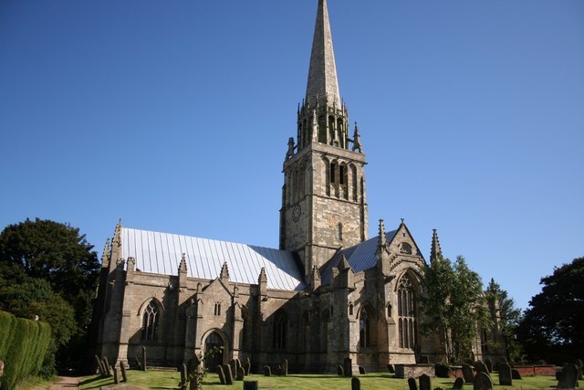
Photo: Richard Croft, CC BY-SA 2.0.
St Patrick's Church, Patrington is an Anglican parish church located in Patrington, East Riding of Yorkshire, England. The church is a Grade I listed building.
Church of St Germain
Church

Photo: Paul Glazzard, CC BY-SA 2.0.
Church of St Germain is situated 2 miles north of North Channel Clough.
St Mary’s Church, Welwick
Church
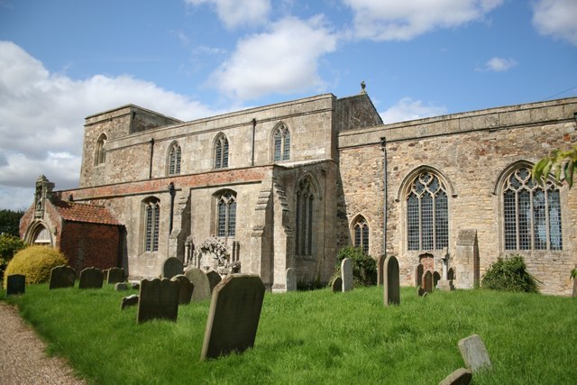
Photo: Richard Croft, CC BY-SA 2.0.
St Mary's Church is an Anglican parish church in the English village of Welwick in the East Riding of Yorkshire. It is a Grade I listed building. St Mary’s Church, Welwick is situated 2½ miles east of North Channel Clough.
Places in the Area
Nearby places include Patrington Haven and Patrington.
Patrington Haven
Village
Photo: Patrington Haven, Public domain.
Patrington Haven is a hamlet in the East Riding of Yorkshire, England, in an area known as Holderness. It is situated approximately 8 miles south-east of the town of Hedon and 1 mile south-west of the village of Patrington.
Patrington
Village

Photo: Keith D, CC BY-SA 3.0.
Patrington is a large village and civil parish in the East Riding of Yorkshire, England, in an area known as Holderness, 9 miles south-east of Hedon, 16 miles south-east of Kingston upon Hull and 4 miles south-west of Withernsea on the A1033.
Winestead
Village

Photo: Paul Glazzard, CC BY-SA 2.0.
Winestead is a village in the civil parish of Patrington, in the East Riding of Yorkshire, England, in an area known as Holderness. It is situated approximately seven miles south-east of Hedon and 1+1⁄2 miles north-west of Patrington. Winestead is situated 2½ miles north of North Channel Clough.
North Channel Clough
- Type: Locality
- Location: Patrington, East Yorkshire, Yorkshire, England, United Kingdom, Britain and Ireland, Europe
- View on OpenStreetMap
Latitude
53.66513° or 53° 39′ 55″ northLongitude
-0.03002° or 0° 1′ 48″ westOpen location code
9C5XMX89+3XOpenStreetMap ID
node 3693253727OpenStreetMap feature
place=locality
This page is based on OpenStreetMap, Wikidata, and Wikimedia Commons.
We’d love your help improving our open data sources. Thank you for contributing.
Satellite Map
Discover North Channel Clough from above in high-definition satellite imagery.
Localities in the Area
Explore places such as East Growths and Brick Bridge.
Notable Places Nearby
Highlights include Patrington Haven Leisure Park and Omascreek Plantation.
East Yorkshire: Must-Visit Destinations
Delve into Kingston upon Hull, Beverley, Bridlington, and Hornsea.
Curious Localities to Discover
Uncover intriguing localities from every corner of the globe.
About Mapcarta. Data © OpenStreetMap contributors and available under the Open Database License". Text is available under the CC BY-SA 4.0 license, except for photos, directions, and the map. Photo: AlasdairW, CC BY-SA 3.0.