The Chesils / Knoll Drive
The Chesils / Knoll Drive is a bus stop in Coventry, England. The Chesils / Knoll Drive is situated nearby to St Thomas More RC Church, as well as near West Orchard Church Hall.| Tap on a place to explore it |
Places of Interest Nearby
Highlights include Coventry railway station and Criterion Theatre.
Coventry railway station
Railway station
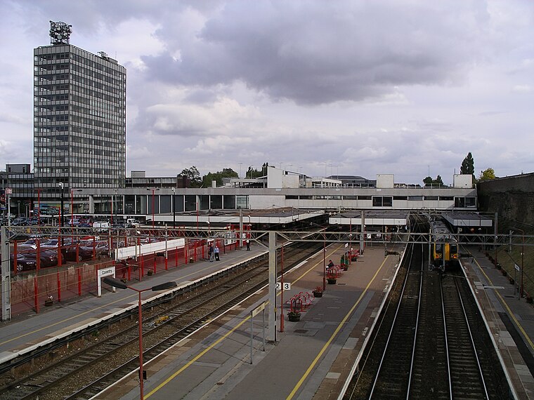
Photo: Snowmanradio, CC BY-SA 3.0.
Coventry railway station serves the city of Coventry, in the West Midlands, England. It lies on the Birmingham loop of the West Coast Main Line; it is also located at the centre of a junction where the lines to Nuneaton and to Leamington converge. Coventry railway station is situated 1 mile north of The Chesils / Knoll Drive.
Criterion Theatre
Theater building

Photo: Snowmanradio, CC BY-SA 4.0.
The Criterion Theatre is situated in Earlsdon, Coventry, England. It puts on about seven shows a year. The company has won the Godiva Award for best theatre in the region several times. Criterion Theatre is situated 1¼ miles northwest of The Chesils / Knoll Drive.
Lunt Roman Fort

Photo: Snowmanradio, CC BY-SA 3.0.
The Lunt Roman Fort is the archaeological site of a Roman fort, of unknown name, in the Roman province of Britannia. It is open to the public and located in the village of Baginton on the south eastern outskirts of Coventry. Lunt Roman Fort is situated 1 mile southeast of The Chesils / Knoll Drive.
Places in the Area
Nearby places include Stivichall and Cheylesmore.
Stivichall
Suburb
Stivichall or Styvechale is a suburb of the city of Coventry, in the county of the West Midlands, England. It is a mainly residential area in the south of the city.
Cheylesmore
Suburb

Photo: Snowmanradio, CC BY-SA 3.0.
Cheylesmore is a suburb in the southern half of the city of Coventry, West Midlands, England. It is one of Coventry's largest suburbs, sharing borders with Whitley and Stivichall in the South, extending into Coventry city centre and bordering with Earlsdon in the North.

The Chesils / Knoll Drive
- Type: Bus stop
- Category: transportation
- Location: Coventry, England, United Kingdom, Britain and Ireland, Europe
- View on OpenStreetMap
Latitude
52.38622° or 52° 23′ 10″ northLongitude
-1.51098° or 1° 30′ 40″ westOpen location code
9C4W9FPQ+FJOpenStreetMap ID
node 370819071OpenStreetMap feature
highway=bus_stopOpenStreetMap feature
public_transport=platform
This page is based on OpenStreetMap, Wikidata, and Wikimedia Commons.
We’d love your help improving our open data sources. Thank you for contributing.
Satellite Map
Discover The Chesils / Knoll Drive from above in high-definition satellite imagery.
Notable Places Nearby
Highlights include St Thomas More RC Church and West Orchard Church Hall.
Nearby Places
Explore places such as The Chesils / Knoll Drive and The Chesils / Dillotford Avenue.
England: Must-Visit Destinations
Delve into London, Manchester, Sheffield, and Leeds.
Curious Bus Stops to Discover
Uncover intriguing bus stops from every corner of the globe.
About Mapcarta. Data © OpenStreetMap contributors and available under the Open Database License". Text is available under the CC BY-SA 4.0 license, except for photos, directions, and the map. Photo: Mintchocicecream, CC0.