Administration communale de Gedinne
Administration communale de Gedinne is a town hall in Gedinne, Arrondissement de Dinant, Wallonia which is located on Rue Albert Marchal. Administration communale de Gedinne is situated nearby to the church Église Notre-Dame de la Nativité, as well as near the library Bibliothèque communale.| Tap on a place to explore it |
Places of Interest Nearby
Highlights include Gedinne railway station.
Gedinne railway station
Railway station
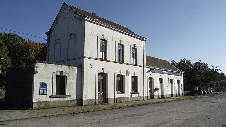
Photo: Smiley.toerist, CC0.
Gedinne railway station is situated 3 km east of Administration communale de Gedinne.
Places in the Area
Nearby places include Louette-Saint-Pierre and Patignies.
Louette-Saint-Pierre
Village

Photo: Jean-Pol GRANDMONT, CC BY-SA 3.0.
Louette-Saint-Pierre is a village.

Sart-Custinne
Village

Photo: Jean-Pol GRANDMONT, CC BY-SA 3.0.
Sart-Custinne is a village, which is situated 2½ km northwest of Administration communale de Gedinne.
Administration communale de Gedinne
- Type: Town hall
- Address: Rue Albert Marchal 2, Gedinne
- Category: government building
- Location: Gedinne, Arrondissement de Dinant, Namur, Wallonia, Belgium, Benelux, Europe
- View on OpenStreetMap
Latitude
49.98071° or 49° 58′ 51″ northLongitude
4.9367° or 4° 56′ 12″ eastOpen location code
8FX6XWJP+7MOpenStreetMap ID
node 3709241717OpenStreetMap feature
amenity=townhall
This page is based on OpenStreetMap, Wikidata, and Wikimedia Commons.
We’d love your help improving our open data sources. Thank you for contributing.
Satellite Map
Discover Administration communale de Gedinne from above in high-definition satellite imagery.
Notable Places Nearby
Highlights include Église Notre-Dame de la Nativité and Bibliothèque communale.
Nearby Places
Explore places such as 3 Arcs Medical and École communale de Gedinne.
Curious Town Halls to Discover
Uncover intriguing town halls from every corner of the globe.
About Mapcarta. Data © OpenStreetMap contributors and available under the Open Database License". Text is available under the CC BY-SA 4.0 license, except for photos, directions, and the map. Photo: Zairon, CC BY-SA 4.0.