S Murray
S Murray is a jewelry shop in Newcastle upon Tyne, England. S Murray is situated nearby to Duke Of Northumberland Public House, as well as near the marketplace Grainger Market.| Tap on a place to explore it |
Places of Interest Nearby
Highlights include St James’ Park and Grainger Market.
St James’ Park
Stadium
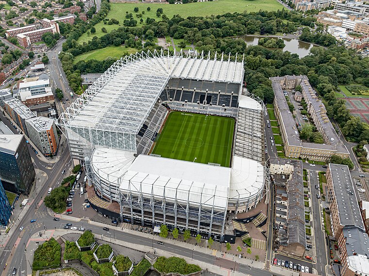
Photo: Arne mueseler, CC BY-SA 3.0 de.
St James' Park is a football stadium in Newcastle upon Tyne, England. It is the home of Newcastle United. With a seating capacity of 52,264, it is the 9th largest football stadium in England. St James’ Park is situated 1,700 feet northwest of S Murray.

Eldon Square Shopping Centre
Shopping center

Photo: TubularWorld, CC BY-SA 3.0.
Eldon Square is a shopping centre in Newcastle upon Tyne, England. It opened in 1976 on the site of Old Eldon Square, a famous part of Georgian Newcastle designed by John Dobson in 1824. Eldon Square Shopping Centre is situated 530 feet north of S Murray.
Places in the Area
Nearby places include Grainger Town and Chinatown.
Grainger Town
Suburb

Photo: EL36ML, CC BY-SA 3.0.
Grainger Town is the historic commercial centre of Newcastle upon Tyne, England. It covers approximately 36 ha. Almost all of Grainger Town is in Newcastle's Central Conservation Area, one of the first designated in England.
Chinatown
Locality
 The Chinatown in Newcastle is a district of Newcastle upon Tyne, located in the west of the city, on the edge of the shopping and commercial centre, along Stowell Street.
Haymarket
Suburb
Haymarket is an area in the north of central Newcastle upon Tyne. The area has several transport hubs including Eldon Square bus station, Haymarket bus station and Haymarket Metro station.
S Murray
- Type: Jewelry shop
- Category: shop
- Location: Newcastle upon Tyne, England, United Kingdom, Britain and Ireland, Europe
- View on OpenStreetMap
Latitude
54.97264° or 54° 58′ 22″ northLongitude
-1.61588° or 1° 36′ 57″ westOpen location code
9C6WX9FM+3MOpenStreetMap ID
node 3735706002OpenStreetMap feature
shop=jewelry
This page is based on OpenStreetMap, Wikidata, and Wikimedia Commons.
We’d love your help improving our open data sources. Thank you for contributing.
Satellite Map
Discover S Murray from above in high-definition satellite imagery.
Notable Places Nearby
Highlights include Duke Of Northumberland Public House and Maldron Hotel Newcastle.
Nearby Places
Explore places such as Greggs and Reel Star.
England: Must-Visit Destinations
Delve into London, Manchester, Sheffield, and Leeds.
Curious Jewelry Shops to Discover
Uncover intriguing jewelry shops from every corner of the globe.
About Mapcarta. Data © OpenStreetMap contributors and available under the Open Database License". Text is available under the CC BY-SA 4.0 license, except for photos, directions, and the map. Photo: sidibousaid, CC BY 2.0.