Parque Estuário
Parque Estuário is a suburb in Guarujá, Santos and South Coast, São Paulo. Parque Estuário is situated nearby to the village Vicente de Carvalho, as well as near the suburb Itapema.| Tap on a place to explore it |
Places of Interest
Highlights include Coliseu Theater and Santos City Hall.
Coliseu Theater
Theater building

Photo: Mike Peel, CC BY-SA 4.0.
Coliseu Theater is a theater building, which is situated 3 km west of Parque Estuário.
Santos City Hall
Town hall

Photo: Fulviusbsas, CC BY-SA 4.0.
Santos City Hall is a town hall, which is situated 3½ km west of Parque Estuário.
Our Lady of the Rosary Cathedral, Santos
Church

Photo: Fulviusbsas, CC BY-SA 3.0.
The Our Lady of the Rosary Cathedral, also known as Santos Cathedral. Is a Catholic church in the city of Santos, in São Paulo State, Brazil. It is the headquarters of the Diocese of Santos and the Parish of Our Lady of Rosario Aparecida, the oldest in the city. Our Lady of the Rosary Cathedral, Santos is situated 3 km west of Parque Estuário.
Places in the Area
Nearby places include Centro and Santos.
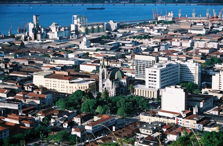
Santos

Photo: Wikimedia, CC BY-SA 2.0.
Santos is a city in the south of the state of São Paulo, Brazil. Santos is the core city of Baixada Santista, a coastal metropolitan area, and contains the most important port in South America.

Parque Estuário
- Type: Suburb
- Category: locality
- Location: Guarujá, Santos and South Coast, São Paulo, Southeast, Brazil, South America
- View on OpenStreetMap
Latitude
-23.94048° or 23° 56′ 26″ southLongitude
-46.29327° or 46° 17′ 36″ westOpen location code
588M3P54+RMOpenStreetMap ID
node 3736282310OpenStreetMap feature
place=suburb
This page is based on OpenStreetMap, Wikidata, and Wikimedia Commons.
We’d love your help improving our open data sources. Thank you for contributing.
Satellite Map
Discover Parque Estuário from above in high-definition satellite imagery.
Localities in the Area
Explore places such as Vicente de Carvalho and Itapema.
Notable Places Nearby
Highlights include Praça 14 Bis and Ministério Evangélico Palavra de Vida.
Santos and South Coast: Must-Visit Destinations
Delve into Santos, São Vicente, Cubatão, and Praia Grande.
Curious Suburbs to Discover
Uncover intriguing suburbs from every corner of the globe.
About Mapcarta. Data © OpenStreetMap contributors and available under the Open Database License". Text is available under the CC BY-SA 4.0 license, except for photos, directions, and the map. Photo: Wikimedia, CC BY-SA 3.0.