Rainbow 2000
Rainbow 2000 is a fast food restaurant in Sefton, England which is located on Liverpool Road. Rainbow 2000 is situated nearby to Birkdale Post Office, as well as near St Peter’s Church, Birkdale.| Tap on a place to explore it |
- Type: Fast food restaurant
- Cuisine: fish and chips
- Address: 49 Liverpool Road, Birkdale, Southport, PR8 4AG
Places of Interest Nearby
Highlights include Birkdale railway station and St Peter’s Church, Birkdale.
Birkdale railway station
Railway station

Photo: Small-town hero, Public domain.
Birkdale railway station serves the Birkdale suburb of Southport, England. The station is on the Southport branch of the Merseyrail network's Northern line. Birkdale railway station is situated 620 feet northwest of Rainbow 2000.
St Peter’s Church, Birkdale
Church

Photo: David Long, CC BY-SA 2.0.
St Peter's Church is in St Peter's Road, Birkdale, Southport, Sefton, Merseyside, England, and is an active Anglican parish church in the diocese of Liverpool. St Peter’s Church, Birkdale is situated 560 feet southeast of Rainbow 2000.
British Lawnmower Museum
Museum
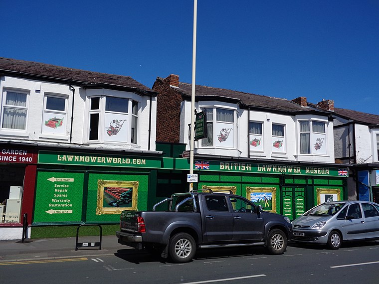
Photo: Rept0n1x, CC BY-SA 2.0.
The British Lawnmower Museum is a museum dedicated to the history of the lawn mowers in Southport, Merseyside, northern England. The museum was opened in 1991 by Brian Radam, operating alongside his family business selling lawnmowers. British Lawnmower Museum is situated 2,700 feet northeast of Rainbow 2000.
Places in the Area
Nearby places include Birkdale and Southport.
Birkdale
Suburb

Photo: Small-town hero, Public domain.
Birkdale is an area of Southport, within the Metropolitan Borough of Sefton, Merseyside, in the north-west of England. The area is on the Irish Sea coast, and forms the southern part of Southport's built-up area.
Southport

Photo: fieldsofview, CC BY 2.0.
Southport is a large tourist town of 91,703 on the coast, just north of Liverpool. It is in the borough of Sefton in Merseyside. It is in the historic county of Lancashire.
Meols Cop
Suburb
Meols Cop is a small area within the Blowick suburb, in the coastal town of Southport, Merseyside in north-western England. It is not a suburb or ward in its own right. Meols Cop is situated 1½ miles northeast of Rainbow 2000.
Rainbow 2000
- Categories: food and restaurant
- Location: Sefton, England, United Kingdom, Britain and Ireland, Europe
- View on OpenStreetMap
Latitude
53.63295° or 53° 37′ 59″ northLongitude
-3.01221° or 3° 0′ 44″ westOpen location code
9C5RJXMQ+54OpenStreetMap ID
node 3742524479OpenStreetMap feature
amenity=fast_foodOpenStreetMap attribute
cuisine=fish_and_chips
This page is based on OpenStreetMap, Wikidata, and Wikimedia Commons.
We’d love your help improving our open data sources. Thank you for contributing.
Satellite Map
Discover Rainbow 2000 from above in high-definition satellite imagery.
Places with the Same Name
Discover other places named “Rainbow 2000”.
Notable Places Nearby
Highlights include Birkdale Post Office and Birkdale.
Nearby Places
Explore places such as Sainsbury’s Local and Vanity Hair.
England: Must-Visit Destinations
Delve into London, Manchester, Sheffield, and Leeds.
Curious Fast Food Restaurants to Discover
Uncover intriguing fast food restaurants from every corner of the globe.
About Mapcarta. Data © OpenStreetMap contributors and available under the Open Database License". Text is available under the CC BY-SA 4.0 license, except for photos, directions, and the map. Photo: sidibousaid, CC BY 2.0.