Katie O’Briens Irish Tavern
Katie O’Briens Irish Tavern is a pub in Leicester, England which is located on Market Street. Katie O’Briens Irish Tavern is situated nearby to the courthouse Leicester Magistrates‘ Court, as well as near Leicester Central Library.| Tap on a place to explore it |
- Opening hours:
Sunday—Thursday: noon—10:00 PM
Friday and Saturday: 9:00 AM—11:00 PM - Type: Pub
- Address: 17-19 Market Street, Leicester, LE1 6DN
Places of Interest Nearby
Highlights include Leicester Cathedral and Town Hall Square.
Leicester Cathedral
Church
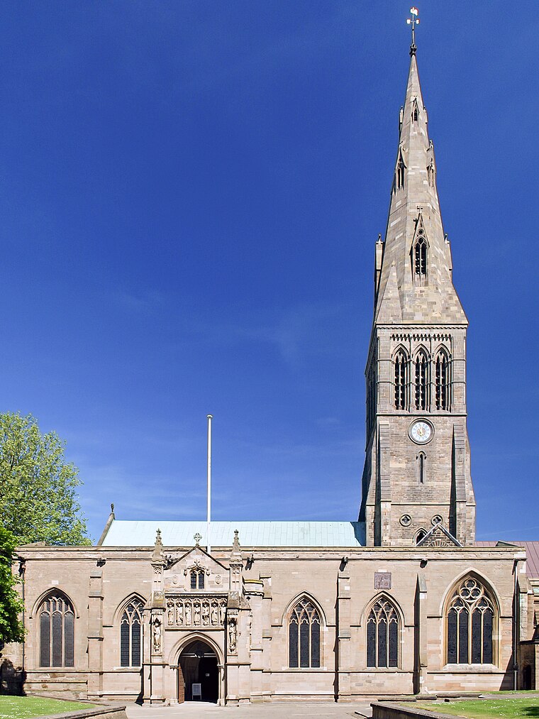
Photo: NotFromUtrecht, CC BY-SA 3.0.
The Cathedral Church of Saint Martin, Leicester, commonly known as Leicester Cathedral, is a Church of England cathedral in Leicester, England, and the seat of the Bishop of Leicester. Leicester Cathedral is situated 1,000 feet northwest of Katie O’Briens Irish Tavern.
Town Hall Square
Park

Photo: Kris1973, CC BY-SA 4.0.
Town Hall Square is a park, which is situated 470 feet northeast of Katie O’Briens Irish Tavern.
Greyfriars
Archaeological site
Greyfriars, Leicester, was a friary of the Order of Friars Minor, commonly known as the Franciscans, established on the west side of Leicester by 1250, and dissolved in 1538. Greyfriars is situated 760 feet northwest of Katie O’Briens Irish Tavern.
Places in the Area
Nearby places include Bede Island and Newfoundpool.
Bede Island
Suburb
Bede Island is an area of Leicester, England close to the city centre, with the River Soar to the west and Grand Union Canal to the east. For many years Bede Island South was a run down area of brownfield land home to Vic Berry's locomotive scrapyard but in the 1990s urban regeneration sought to improve housing, employment opportunities and the environment in the area.
Newfoundpool
Suburb
Newfoundpool is an area of Leicester lying south of the former Leicester and Swannington Railway. The land was purchased by market gardener Isaac Harrison in around 1830.
Latimer
Suburb
Latimer was an electoral ward and administrative division of the city of Leicester, England, consisting of the residential suburb of St Marks.
Katie O’Briens Irish Tavern
Latitude
52.63276° or 52° 37′ 58″ northLongitude
-1.13364° or 1° 8′ 1″ westOpen location code
9C4WJVM8+4GOpenStreetMap ID
node 3747326548OpenStreetMap feature
amenity=pub
This page is based on OpenStreetMap, Wikidata, and Wikimedia Commons.
We’d love your help improving our open data sources. Thank you for contributing.
Satellite Map
Discover Katie O’Briens Irish Tavern from above in high-definition satellite imagery.
Notable Places Nearby
Highlights include Leicester Magistrates‘ Court and Leicester Central Library.
Nearby Places
Explore places such as Oxfam and LOROS by design.
England: Must-Visit Destinations
Delve into London, Manchester, Sheffield, and Leeds.
Curious Pubs to Discover
Uncover intriguing pubs from every corner of the globe.
About Mapcarta. Data © OpenStreetMap contributors and available under the Open Database License". Text is available under the CC BY-SA 4.0 license, except for photos, directions, and the map. Photo: zaphad1, CC BY 2.0.