Werrabahn
Werrabahn is in Lichtenfels, Upper Franconia, Bavaria. Werrabahn is situated nearby to the church Friedhofskapelle St. Antonius, as well as near the place of worship Aussegnungshalle.| Tap on a place to explore it |
Places of Interest Nearby
Highlights include Schloss Schney and Porzellanfabrik.
Schloss Schney
Castle

Photo: Ermell, CC BY-SA 4.0.
Schloss Schney is a castle, which is situated 450 metres north of Werrabahn.
Porzellanfabrik
Building
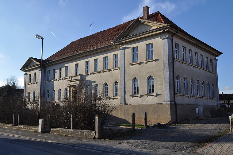
Photo: Ajepbah, CC BY-SA 3.0 de.
Porzellanfabrik is a building, which is situated 410 metres west of Werrabahn.
Torhaus
Building

Photo: Ajepbah, CC BY-SA 3.0 de.
Torhaus is a building, which is situated 470 metres north of Werrabahn.
Places in the Area
Nearby places include Unterwallenstadt and Oberwallenstadt.


Werrabahn
- Type: Sign
- Categories: information and tourism
- Location: Lichtenfels, Upper Franconia, Franconia, Bavaria, Germany, Central Europe, Europe
- View on OpenStreetMap
Latitude
50.16014° or 50° 9′ 37″ northLongitude
11.07557° or 11° 4′ 32″ eastOpen location code
9F2H536G+36OpenStreetMap ID
node 3800765970OpenStreetMap feature
tourism=information
This page is based on OpenStreetMap, Wikidata, and Wikimedia Commons.
We’d love your help improving our open data sources. Thank you for contributing.
Satellite Map
Discover Werrabahn from above in high-definition satellite imagery.
Notable Places Nearby
Highlights include Friedhofskapelle St. Antonius and Aussegnungshalle.
Nearby Places
Explore places such as Südlich Schney and AWV Coburg.
Upper Franconia: Must-Visit Destinations
Delve into Bamberg, Bayreuth, Coburg, and Hof.
Curious Places to Discover
Uncover intriguing places from every corner of the globe.
About Mapcarta. Data © OpenStreetMap contributors and available under the Open Database License". Text is available under the CC BY-SA 4.0 license, except for photos, directions, and the map. Photo: Wikimedia, CC0.