Tabagie Ravin
Tabagie Ravin is a convenience store in Pamplemousses, Mauritius. Tabagie Ravin is situated nearby to Old Sugar Mill Model, as well as near the shopping center Mahogany Shopping Promenade.| Tap on a place to explore it |
Places of Interest Nearby
Highlights include Sir Seewoosagur Ramgoolam Botanical Garden and L’Aventure du Sucre.
Sir Seewoosagur Ramgoolam Botanical Garden
Garden

Photo: Lonelyplanet, CC BY-SA 3.0 de.
The Sir Seewoosagur Ramgoolam Botanic Garden, commonly known as the Pamplemousses Botanic Garden, is a popular tourist attraction in Pamplemousses, near Port Louis, Mauritius, and the oldest botanical garden in the Southern Hemisphere. Sir Seewoosagur Ramgoolam Botanical Garden is situated 1 km south of Tabagie Ravin.
L’Aventure du Sucre
Museum

Photo: Wikimedia, CC BY-SA 4.0.
L’Aventure du Sucre is a museum, which is situated 1 km west of Tabagie Ravin.
Pamplemousses Cemetery
Cemetery
 Pamplemousses Cemetery is situated 1¼ km southwest of Tabagie Ravin.
Places in the Area
Nearby places include Mapou and Belle Vue Harel.
Mapou
Village
Mapou is a village in northern Mauritius, located in Rivière du Rempart District. The village is administered by the Mapou Village Council under the aegis of the Rivière du Rempart District Council. Mapou is situated 3½ km northeast of Tabagie Ravin.
Belle Vue Harel
Hamlet
Belle Vue Harel is a village in Mauritius that is located in the Pamplemousses District in the northern part of the island. It is located next to Plaine des Papayes village. Belle Vue Harel is situated 4 km northeast of Tabagie Ravin.
Triolet
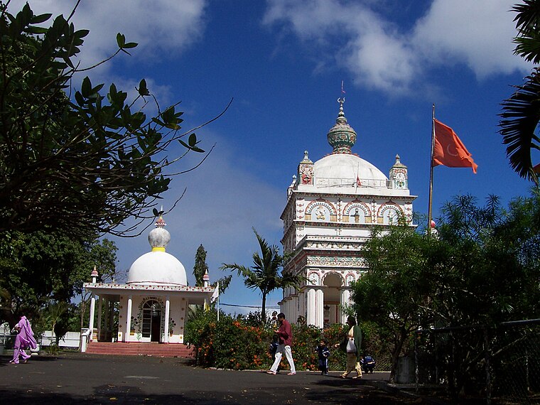
Photo: Toutaitanous 2, CC BY-SA 3.0.
Triolet is a medium-sized town in the north of the Mauritius district of Pamplemousses. It lies exactly 11 kilometres from Port Louis, the capital of the island.
Tabagie Ravin
- Type: Convenience store
- Categories: shop and food
- Location: Pamplemousses, Mauritius, East African Islands, Africa
- View on OpenStreetMap
Latitude
-20.09993° or 20° 5′ 60″ southLongitude
57.58286° or 57° 34′ 58″ eastOpen location code
5HFVWH2M+24OpenStreetMap ID
node 3999764440OpenStreetMap feature
shop=convenience
This page is based on OpenStreetMap, Wikidata, and Wikimedia Commons.
We’d love your help improving our open data sources. Thank you for contributing.
Satellite Map
Discover Tabagie Ravin from above in high-definition satellite imagery.
Notable Places Nearby
Highlights include Old Sugar Mill Model and Mahogany Shopping Promenade.
Nearby Places
Explore places such as Banj Restaurant Gamaran Rouge and Mango Village.
Mauritius: Must-Visit Destinations
Delve into Port Louis, Rodrigues, Le Morne Brabant, and Curepipe.
Curious Convenience Stores to Discover
Uncover intriguing convenience stores from every corner of the globe.
About Mapcarta. Data © OpenStreetMap contributors and available under the Open Database License". Text is available under the CC BY-SA 4.0 license, except for photos, directions, and the map. Photo: Simisa, CC BY-SA 3.0.