Samuel Oppenheim
Samuel Oppenheim is a memorial in Düsseldorf, Lower Rhine, North Rhine-Westphalia. Samuel Oppenheim is situated nearby to the playground Michaelplatz, as well as near Geissel.| Tap on a place to explore it |
Places of Interest Nearby
Highlights include Düsseldorf Arcaden and Karl-Arnold-Haus.
Düsseldorf Arcaden
Shopping center

Photo: Wikimedia, CC BY-SA 3.0 de.
Düsseldorf Arcaden is a shopping center, which is situated 370 metres northeast of Samuel Oppenheim.
Karl-Arnold-Haus
Public building
 Karl-Arnold-Haus is a public building, which is situated 430 metres north of Samuel Oppenheim.
Florapark
Park

Photo: Marek Gehrmann, CC BY-SA 3.0.
Florapark is situated 470 metres north of Samuel Oppenheim.
Places in the Area
Nearby places include Unterbilk and Düsseldorf-Bilk.
Unterbilk
Suburb
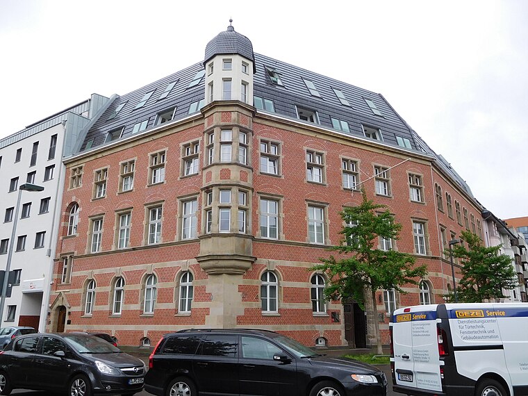
Photo: JiriMatejicek, CC BY-SA 4.0.
Unterbilk is an urban quarter in Borough 3 of the North Rhine-Westphalia state capital Düsseldorf. It is the seat of the Landtag of North Rhine-Westphalia, the Rheinturm tower and, together with the Düsseldorf docks is the centre of the media industry in Düsseldorf.
Düsseldorf-Bilk
Suburb
 Bilk is a quarter of Düsseldorf. Together with Oberbilk, Unterbilk, Hamm, Flehe and Volmerswerth it constitutes Borough 3, which is the most populous borough of Düsseldorf.
Düsseldorf-Friedrichstadt
Suburb
Friedrichstadt is an urban quarter of Düsseldorf, part of Borough 3. It is south of the city centre of Düsseldorf, north of Bilk, west of Oberbilk, and east of Unterbilk.
Samuel Oppenheim
- Type: Memorial
- Inscription: “Hier wohnte Samuel Oppenheim, Jg. 1884, deportiert 1941 Lodz, ermordet 9.5.1942”
- Category: historic site
- Location: Düsseldorf, Düsseldorf, Lower Rhine, North Rhine-Westphalia, Germany, Central Europe, Europe
- View on OpenStreetMap
Latitude
51.20564° or 51° 12′ 20″ northLongitude
6.77145° or 6° 46′ 17″ eastOpen location code
9F386Q4C+7HOpenStreetMap ID
node 4077695035OpenStreetMap feature
historic=memorial
This page is based on OpenStreetMap, Wikidata, and Wikimedia Commons.
We’d love your help improving our open data sources. Thank you for contributing.
Satellite Map
Discover Samuel Oppenheim from above in high-definition satellite imagery.
Notable Places Nearby
Highlights include Michaelplatz and Geissel.
Nearby Places
Explore places such as Klothilde Oppenheim and TRATTORIA Gallo Nero.
Lower Rhine: Must-Visit Destinations
Delve into Mönchengladbach, Krefeld, Neuss, and Kleve.
Curious Memorials to Discover
Uncover intriguing memorials from every corner of the globe.
About Mapcarta. Data © OpenStreetMap contributors and available under the Open Database License". Text is available under the CC BY-SA 4.0 license, except for photos, directions, and the map. Photo: Steff, CC BY-SA 3.0.