Enderby Pharmacy
Enderby Pharmacy is a pharmacy in Enderby, Blaby, England which is located on Mill Lane. Enderby Pharmacy is situated nearby to the sports venue Enderby Cricket Club, as well as near Enderby Methodist Church.| Tap on a place to explore it |
Places of Interest Nearby
Highlights include Brockington College and Narborough railway station.
Brockington College
School
Brockington College is a college in Church of England. It is a mixed secondary school in Enderby, Leicestershire, England within the district of Blaby. It became an academy on August 1, 2012. Brockington College is situated 1,700 feet southeast of Enderby Pharmacy.
Narborough railway station
Railway station
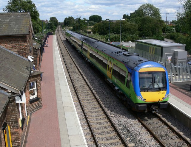
Photo: Mat Fascione, CC BY-SA 2.0.
Narborough railway station serves the large village of Narborough and the small village of Littlethorpe in Leicestershire. It is on the Birmingham to Peterborough Line about 7 miles southwest of Leicester. Narborough railway station is situated 1¼ miles south of Enderby Pharmacy.
Narborough Bog
Nature reserve

Photo: Dudley Miles, CC BY-SA 4.0.
Narborough Bog is an 8.5-hectare biological Site of Special Scientific Interest east of Narborough in Leicestershire. It is owned and managed by the Leicestershire and Rutland Wildlife Trust.
Places in the Area
Nearby places include Narborough and Lubbesthorpe.
Narborough
Village
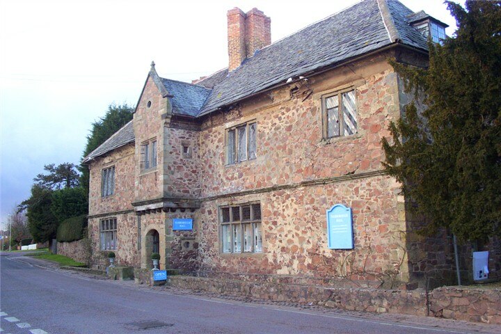
Photo: Kev747, Public domain.
Narborough is a large village and civil parish in the Blaby district of Leicestershire, England, around six miles southwest of Leicester. The population of the civil parish at the 2011 census was 8,498.
Lubbesthorpe
Hamlet
Lubbesthorpe is a hamlet and parish in the district of Blaby within Enderby on the outskirts of Leicester, England, on the west side of the M1 motorway and the River Soar.
Littlethorpe
Village
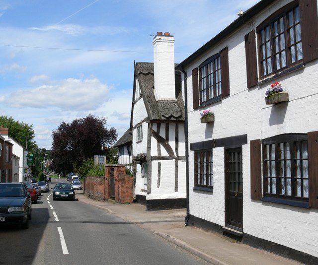
Photo: Mat Fascione, CC BY-SA 2.0.
Littlethorpe is a small village approximately six miles south of Leicester, separated from the village of Narborough by the Leicester to Birmingham railway line, and the River Soar of which it is the true discharge.
Enderby Pharmacy
- Type: Pharmacy
- Address: 15 Mill Lane, Enderby, LE19 4NW
- Category: health care
- Location: Enderby, Blaby, Leicestershire, East Midlands, England, United Kingdom, Britain and Ireland, Europe
- View on OpenStreetMap
Latitude
52.58747° or 52° 35′ 15″ northLongitude
-1.20814° or 1° 12′ 29″ westOpen location code
9C4WHQPR+XPOpenStreetMap ID
node 4158539965OpenStreetMap feature
amenity=pharmacyOpenStreetMap feature
healthcare=pharmacy
This page is based on OpenStreetMap, Wikidata, and Wikimedia Commons.
We’d love your help improving our open data sources. Thank you for contributing.
Satellite Map
Discover Enderby Pharmacy from above in high-definition satellite imagery.
Notable Places Nearby
Highlights include Enderby Cricket Club and Enderby Methodist Church.
Nearby Places
Explore places such as The Barbers Corner and Wok Express.
Leicestershire: Must-Visit Destinations
Delve into Leicester, Loughborough, Hinckley, and Melton Mowbray.
Curious Pharmacies to Discover
Uncover intriguing pharmacies from every corner of the globe.
About Mapcarta. Data © OpenStreetMap contributors and available under the Open Database License". Text is available under the CC BY-SA 4.0 license, except for photos, directions, and the map. Photo: Wikimedia, CC0.