Ochre Farm
Ochre Farm is a farm in Scampston, Ryedale District, England. Ochre Farm is situated nearby to Knapton Power Station, as well as near the forest East Ochre.| Tap on a place to explore it |
Places of Interest Nearby
Highlights include St John’s Church, Yedingham and All Saints’ Church, West Heslerton.
St John’s Church, Yedingham
Church
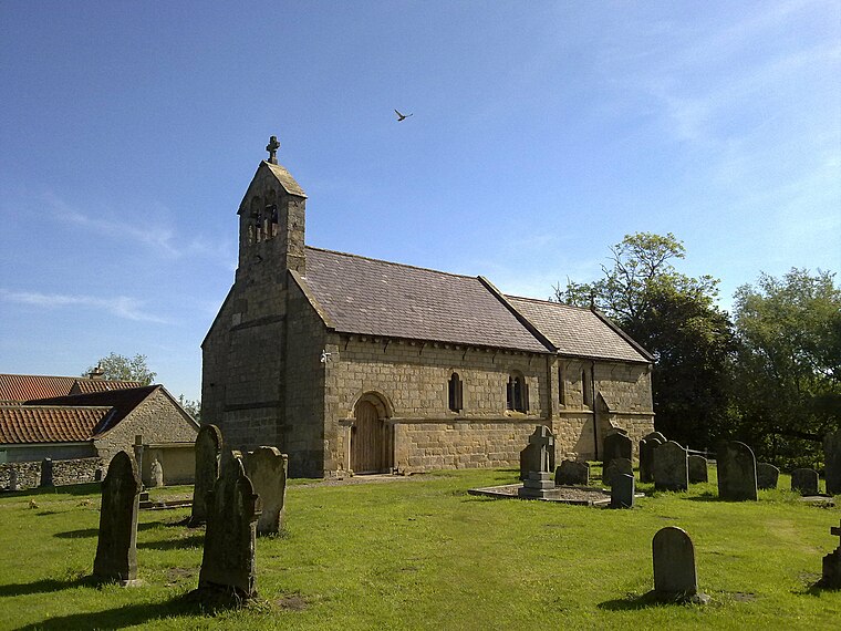
Photo: Nigelcoates, CC BY-SA 3.0.
St John's Church is the parish church of Yedingham, a village in North Yorkshire, in England. A church was built in Yedingham in the 12th century. It was entirely rebuilt between 1862 and 1863, the chancel to a design by William Butterfield, and the nave to a design by William Tuke. St John’s Church, Yedingham is situated 1¼ miles north of Ochre Farm.
All Saints’ Church, West Heslerton
Church

Photo: Martin Dawes, CC BY-SA 2.0.
All Saints' Church is the parish church of West Heslerton, a village in North Yorkshire, in England. The church was built in the 13th century, and was formerly dedicated to Saint Andrew. All Saints’ Church, West Heslerton is situated 1½ miles southeast of Ochre Farm.
St Andrew’s Church
Church

Photo: Nigelcoates, CC BY-SA 3.0.
St Andrew's Church is a redundant Anglican church at the south end of the village of East Heslerton, North Yorkshire, England. It is recorded in the National Heritage List for England as a designated Grade I listed building and is under the care of the Churches Conservation Trust. St Andrew’s Church is situated 2½ miles east of Ochre Farm.
Places in the Area
Nearby places include East Knapton and Yedingham.
East Knapton
Hamlet

Photo: Wikimedia, CC BY-SA 2.0.
East Knapton is a village in the civil parish of Scampston, in North Yorkshire, England.
Yedingham
Village
Photo: Nigelcoates, CC BY-SA 3.0.
Yedingham is a village and former civil parish, now in the parish of Ebberston and Yedingham, halfway between West Knapton and Allerston, nine miles north-east of Malton in North Yorkshire, England.
West Knapton
Hamlet

Photo: Wikimedia, CC BY-SA 2.0.
West Knapton is a small village in the civil parish of Scampston, in North Yorkshire, England. It is situated on the edge of the Yorkshire Wolds at the foot of the North York Moors. West Knapton is situated 1½ miles southwest of Ochre Farm.
Ochre Farm
- Type: Farm
- Categories: locality and agriculture
- Location: Scampston, Ryedale District, North Yorkshire, Yorkshire, England, United Kingdom, Britain and Ireland, Europe
- View on OpenStreetMap
Latitude
54.18658° or 54° 11′ 12″ northLongitude
-0.63666° or 0° 38′ 12″ westOpen location code
9C6X59P7+J8OpenStreetMap ID
node 4168871393OpenStreetMap feature
place=farm
This page is based on OpenStreetMap, Wikidata, and Wikimedia Commons.
We’d love your help improving our open data sources. Thank you for contributing.
Satellite Map
Discover Ochre Farm from above in high-definition satellite imagery.
Notable Places Nearby
Highlights include Knapton Power Station and East Ochre.
Nearby Places
Explore places such as Ings Farm and Guild Farm.
North Yorkshire: Must-Visit Destinations
Delve into York, Middlesbrough, Scarborough, and Ripon.
Curious Farms to Discover
Uncover intriguing farms from every corner of the globe.
About Mapcarta. Data © OpenStreetMap contributors and available under the Open Database License". Text is available under the CC BY-SA 4.0 license, except for photos, directions, and the map. Photo: Michael Bryan, CC BY 2.0.