Carlito Hernandez
Carlito Hernandez is a scenic viewpoint in Los Angeles, Southern California, California. Carlito Hernandez is situated nearby to the marketplace Frank’s Market, as well as near the reservoir Santa Fe Flood Control Basin.| Tap on a place to explore it |
Places of Interest Nearby
Highlights include Baldwin Park station and Helford Clinical Research Hospital at City of Hope.
Baldwin Park station
Railway station
Baldwin Park station is a Metrolink train station in Baldwin Park, California, United States, between Pacific Avenue and Ramona Boulevard next to Baldwin Park City Hall. Baldwin Park station is situated 1¼ miles southeast of Carlito Hernandez.
Helford Clinical Research Hospital at City of Hope
Hospital

Photo: Person-with-No Name, CC BY 2.0.
City of Hope is a private, non-profit clinical research center, hospital and graduate school located in Duarte, California, United States. The center's main campus resides on 110 acres of land adjacent to the boundaries of Duarte and Irwindale, with a network… Helford Clinical Research Hospital at City of Hope is situated 2 miles north of Carlito Hernandez.
Duarte/City of Hope station
Railway station
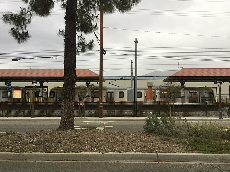
Photo: Northwalker, CC0.
Duarte/City of Hope station is an at-grade light rail station on the A Line of the Los Angeles Metro Rail system. It is located at the intersection of Duarte Road and Highland Avenue in Duarte, California, after which the station is named, along with the City of Hope National Medical Center located across the street from the station. Duarte/City of Hope station is situated 2 miles north of Carlito Hernandez.
Places in the Area
Nearby places include Baldwin Park and Irwindale.
Baldwin Park

Photo: RightCowLeftCoast, CC BY-SA 4.0.
Baldwin Park is a city located in the central San Gabriel Valley region of Los Angeles County, California, United States. As of the 2020 census, the population was 72,176, down from 75,390 at the 2010 census.
Irwindale
Village

Photo: Shinku Hisaki, CC BY-SA 3.0.
Irwindale is a city in the San Gabriel Valley, in Los Angeles County, California. The population was 1,472 at the 2020 census, 1,422 at the 2010 census. Irwindale is situated 2 miles east of Carlito Hernandez.
Vincent
Locality
Vincent, also known as East Irwindale, is a census-designated place in the central San Gabriel Valley, in Los Angeles County, California, United States. Vincent is situated 2½ miles east of Carlito Hernandez.
Carlito Hernandez
- Type: Scenic viewpoint
- Category: tourism
- Location: Los Angeles, Southern California, California, United States, North America
- View on OpenStreetMap
Latitude
34.10215° or 34° 6′ 8″ northLongitude
-117.96711° or 117° 58′ 2″ westOpen location code
8564422M+V5OpenStreetMap ID
node 4322001290OpenStreetMap feature
tourism=viewpoint
This page is based on OpenStreetMap, Wikidata, and Wikimedia Commons.
We’d love your help improving our open data sources. Thank you for contributing.
Satellite Map
Discover Carlito Hernandez from above in high-definition satellite imagery.
Notable Places Nearby
Highlights include Frank’s Market and Iglesia Pentecostal.
Nearby Places
Explore places such as Foothill Transit 272 and Foothill Transit 272.
Los Angeles: Must-Visit Destinations
Delve into Hollywood, San Gabriel Valley, San Fernando Valley, and Long Beach.
Curious Scenic Viewpoints to Discover
Uncover intriguing scenic viewpoints from every corner of the globe.
About Mapcarta. Data © OpenStreetMap contributors and available under the Open Database License". Text is available under the CC BY-SA 4.0 license, except for photos, directions, and the map. Photo: Mfield, CC BY-SA 3.0.