EuroFruits Namur
EuroFruits Namur is a supermarket in Namur, Namur, Wallonia which is located on Boulevard d’Herbatte. EuroFruits Namur is situated nearby to the place of worship Le Chatal, as well as near the forest Bois du Coquelet.| Tap on a place to explore it |
Places of Interest Nearby
Highlights include African museum of Namur and Pont du Luxembourg.
African museum of Namur
Museum

Photo: Ji-Elle, CC BY-SA 4.0.
African museum of Namur is situated 450 metres southwest of EuroFruits Namur.
Pont du Luxembourg
Bridge
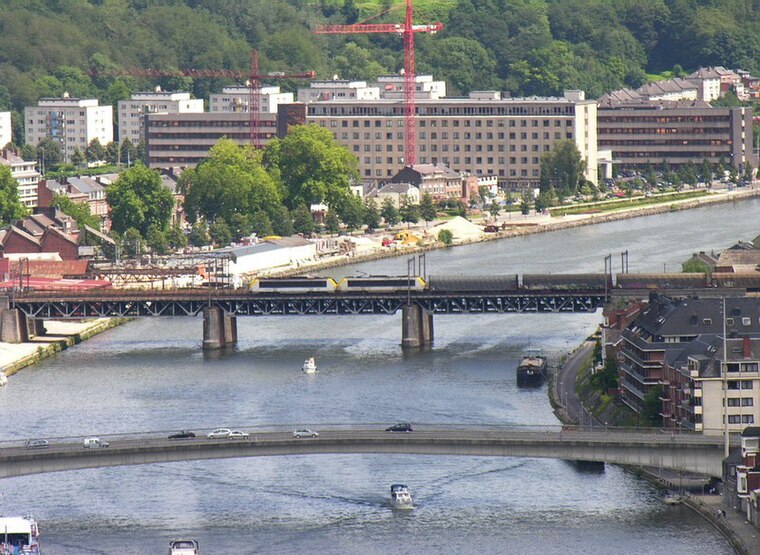
Photo: Wikimedia, CC BY-SA 3.0.
Pont du Luxembourg is a bridge, which is situated 410 metres southeast of EuroFruits Namur.
Church of our Lady of Harscamp
Community center

Photo: Grentidez, Public domain.
Church of our Lady of Harscamp is a community center, which is situated 640 metres southwest of EuroFruits Namur.
Places in the Area
Nearby places include Grognon and Bomel.

Bomel
Hamlet
 Bomel is a borough of the city of Namur, Wallonia. It is located behind the Namur railway station and limited by the slopes that rise to the north of Namur.
Jambes
Town

Photo: Jean-Pol GRANDMONT, CC BY 3.0.
Jambes is a sub-municipality of the city of Namur located in the province of Namur, Wallonia, Belgium. It was a separate municipality until 1977. On 1 January 1977, it was merged into Namur.
EuroFruits Namur
- Type: Supermarket
- Address: Boulevard d’Herbatte 14a, Namur, 5000
- Categories: shop and food
- Location: Namur, Arrondissement of Namur, Namur, Wallonia, Belgium, Benelux, Europe
- View on OpenStreetMap
Latitude
50.4681° or 50° 28′ 5″ northLongitude
4.87707° or 4° 52′ 37″ eastOpen location code
9F26FV9G+6ROpenStreetMap ID
node 4326127744OpenStreetMap feature
shop=supermarket
This page is based on OpenStreetMap, Wikidata, and Wikimedia Commons.
We’d love your help improving our open data sources. Thank you for contributing.
Satellite Map
Discover EuroFruits Namur from above in high-definition satellite imagery.
Notable Places Nearby
Highlights include Le Chatal and Bois du Coquelet.
Nearby Places
Explore places such as BricoNam and Rent A Car Namur.
Curious Supermarkets to Discover
Uncover intriguing supermarkets from every corner of the globe.
About Mapcarta. Data © OpenStreetMap contributors and available under the Open Database License". Text is available under the CC BY-SA 4.0 license, except for photos, directions, and the map. Photo: Guywets, CC BY-SA 3.0.