Earl’s Court Food & Wine
Earl’s Court Food & Wine is a convenience store in South Kensington-Chelsea, Greater London, England which is located on Earl’s Court Road. Earl’s Court Food & Wine is situated nearby to the railway station Earl’s Court tube station (Earl’s Court Road), as well as near Police Box.| Tap on a place to explore it |
Places of Interest Nearby
Highlights include Earl’s Court tube station and Stamford Bridge.
Earl’s Court tube station
Metro station

Photo: Thryduulf, CC BY-SA 4.0.
Earl's Court is a Grade II listed London Underground station in Earl's Court, London, on the District and Piccadilly lines. It is an important interchange for both lines and is situated in both Travelcard Zone 1 and Zone 2.
Stamford Bridge
Stadium

Photo: Arne mueseler, CC BY-SA 3.0 de.
Stamford Bridge is a football stadium in Fulham, in the Borough of Hammersmith and Fulham, in West London. It is the home of Premier League club Chelsea. Stamford Bridge is situated 3,900 feet south of Earl’s Court Food & Wine.
Natural History Museum
Museum
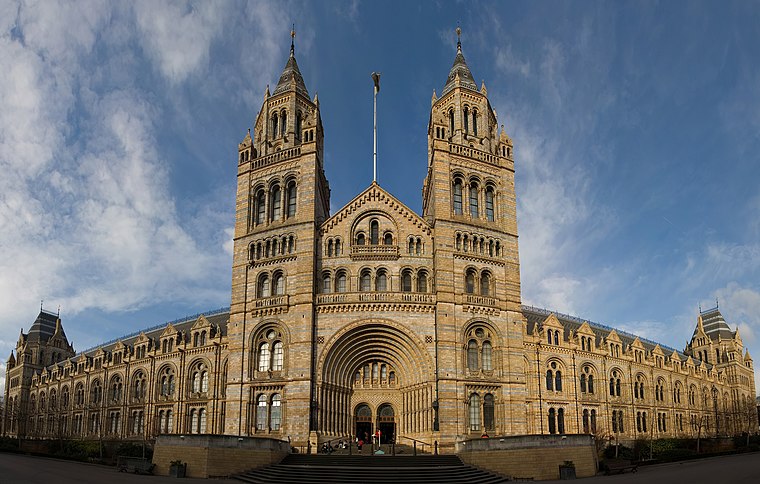
Photo: Diliff, CC BY-SA 3.0.
The Natural History Museum in London is a museum that exhibits a vast range of specimens from various segments of natural history. It is one of three major museums on Exhibition Road in South Kensington, the others being the Science Museum and the Victoria and Albert Museum. Natural History Museum is situated 4,200 feet east of Earl’s Court Food & Wine.
Places in the Area
Nearby places include Earls Court and South Kensington.
Earls Court
Suburb

Photo: Wikimedia, Public domain.
Earl's Court is a district of Kensington in the Royal Borough of Kensington and Chelsea in West London, bordering the rail tracks of the West London line and District line that separate it from the ancient borough of Fulham to the west, the sub-districts of South Kensington to the east, Chelsea to the south and Kensington to the northeast.
South Kensington
Suburb
Photo: Diliff, CC BY-SA 3.0.
South Kensington is a district at the West End of Central London in the Royal Borough of Kensington and Chelsea. Historically it settled on part of the scattered Middlesex village of Brompton.
Kensington
Suburb

Photo: Yaanch, Public domain.
Kensington is an area of London in the Royal Borough of Kensington and Chelsea, around 2.9 miles west of Central London. The district's commercial heart is Kensington High Street, running on an east–west axis.
Earl’s Court Food & Wine
- Type: Convenience store
- Address: 216-218 Earl’s Court Road
- Categories: shop and food
- Location: South Kensington-Chelsea, Greater London, London, England, United Kingdom, Britain and Ireland, Europe
- View on OpenStreetMap
Latitude
51.49226° or 51° 29′ 32″ northLongitude
-0.1933° or 0° 11′ 36″ westOpen location code
9C3XFRR4+WMOpenStreetMap ID
node 4327351738OpenStreetMap feature
shop=convenience
This page is based on OpenStreetMap, Wikidata, and Wikimedia Commons.
We’d love your help improving our open data sources. Thank you for contributing.
Satellite Map
Discover Earl’s Court Food & Wine from above in high-definition satellite imagery.
Notable Places Nearby
Highlights include Earl’s Court tube station (Earl’s Court Road) and Police Box.
Nearby Places
Explore places such as Caffè Nero and Checkpoint.
London: Must-Visit Destinations
Delve into Heathrow Airport, City of London, Westminster, and South London.
Curious Convenience Stores to Discover
Uncover intriguing convenience stores from every corner of the globe.
About Mapcarta. Data © OpenStreetMap contributors and available under the Open Database License". Text is available under the CC BY-SA 4.0 license, except for photos, directions, and the map. Photo: Peter Suranyi, CC BY-SA 3.0.