B & A Stores
B & A Stores is a convenience store in South Tyneside, England which is located on Stanhope Road. B & A Stores is situated nearby to the community center Low Simonside Community Association, as well as near Simonside Primary School.| Tap on a place to explore it |
Places of Interest Nearby
Highlights include Monkwearmouth–Jarrow Abbey and Bede.
Monkwearmouth–Jarrow Abbey
Ruins

Photo: R J McNaughton, CC BY-SA 2.0.
The Abbey Church of Saint Peter and Saint Paul, Monkwearmouth–Jarrow, known simply as Monkwearmouth–Jarrow Abbey, was a Benedictine double monastery in the Kingdom of Northumbria, England. Monkwearmouth–Jarrow Abbey is situated 4,000 feet north of B & A Stores.
Bede
Railway station
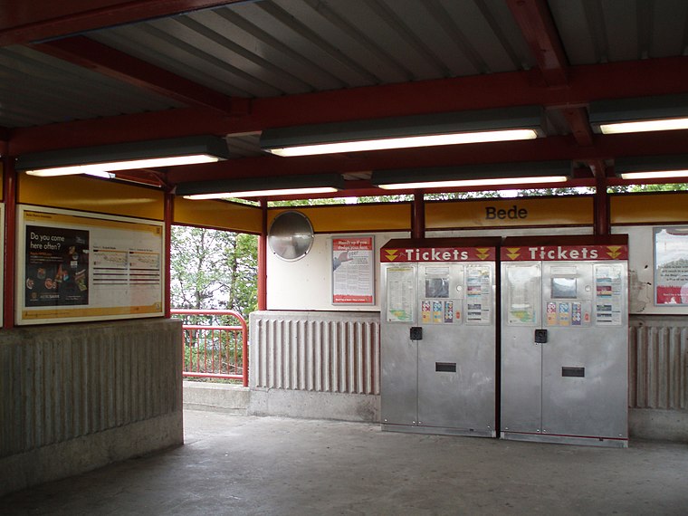
Photo: Mankind 2k, CC BY 2.5.
Bede is a Tyne and Wear Metro station, serving the town of Jarrow, South Tyneside in Tyne and Wear, England. It joined the network on 24 March 1984, following the opening of the fifth phase of the network, between Heworth and South Shields. Bede is situated 2,200 feet northeast of B & A Stores.
Simonside
Railway station

Photo: Mankind 2k, CC BY 3.0.
Simonside is a Tyne and Wear Metro station, serving the suburb of West Harton, South Tyneside in Tyne and Wear, England. It joined the network on 17 March 2008. Simonside is situated 3,500 feet east of B & A Stores.
Places in the Area
Nearby places include Brockley Whins and Primrose.
Brockley Whins
Suburb

Photo: Wikimedia, CC BY-SA 4.0.
Brockley Whins is an area in South Tyneside, part of South Shields, with a postcode of NE32 It is served by Brockley Whins Metro station. The name originates from a farm which was located about 400 metres East, in what is now the Biddick Hall Estate.

Jarrow
Town

Photo: Mark Smiles, CC BY-SA 2.0.
South Tyneside is a borough in Tyne and Wear in northeast England, with a population in 2021 of 148,000. It's a series of towns that have been industrial since the Middle Ages, and that historically lay in County Durham.
B & A Stores
- Type: Convenience store
- Address: Stanhope Road, Jarrow
- Categories: shop and food
- Location: South Tyneside, England, United Kingdom, Britain and Ireland, Europe
- View on OpenStreetMap
Latitude
54.96915° or 54° 58′ 9″ northLongitude
-1.47149° or 1° 28′ 17″ westOpen location code
9C6WXG9H+MCOpenStreetMap ID
node 4350916156OpenStreetMap feature
shop=convenience
This page is based on OpenStreetMap, Wikidata, and Wikimedia Commons.
We’d love your help improving our open data sources. Thank you for contributing.
Satellite Map
Discover B & A Stores from above in high-definition satellite imagery.
Notable Places Nearby
Highlights include Low Simonside Community Association and Simonside Primary School.
Nearby Places
Explore places such as Cash Chippy and Chop Shop Barbers.
England: Must-Visit Destinations
Delve into London, Manchester, Sheffield, and Leeds.
Curious Convenience Stores to Discover
Uncover intriguing convenience stores from every corner of the globe.
About Mapcarta. Data © OpenStreetMap contributors and available under the Open Database License". Text is available under the CC BY-SA 4.0 license, except for photos, directions, and the map. Photo: AlasdairW, CC BY-SA 3.0.