Käsweide
Käsweide is a locality in Rabensburg, Mistelbach District, Lower Austria. Käsweide is situated nearby to the locality Dorf Lehen, as well as near Queräcker.| Tap on a place to explore it |
Places of Interest
Highlights include Church of St. Helena and Feldkapelle Rabensburg.

Feldkapelle Rabensburg
Chapel

Photo: JonnyBrazil, CC BY-SA 3.0 at.
Feldkapelle Rabensburg is a chapel.
Wegkapelle
Wayside shrine
 Wegkapelle is a wayside shrine, which is situated 3½ km south of Käsweide.
Places in the Area
Nearby places include Hohenau an der March and Katzelsdorf.
Hohenau an der March
Village
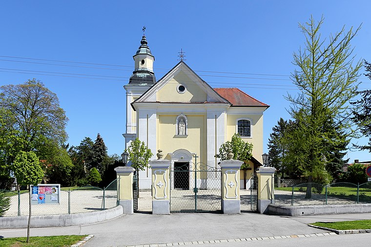
Photo: Bwag, CC BY-SA 4.0.
Hohenau an der March is a town in the district of Gänserndorf in the Austrian state of Lower Austria, close to Vienna and the borders with the Czech Republic and Slovakia. Hohenau an der March is situated 4½ km south of Käsweide.
Katzelsdorf
Village

Photo: Wikimedia, CC BY-SA 3.0.
Katzelsdorf is a village, which is situated 9 km northwest of Käsweide.
Ringelsdorf-Niederabsdorf
Village

Photo: Priwo, Public domain.
Ringelsdorf-Niederabsdorf is a town in the district of Gänserndorf in the Austrian state of Lower Austria. Ringelsdorf-Niederabsdorf is situated 10 km south of Käsweide.
Käsweide
- Type: Locality
- Location: Rabensburg, Mistelbach District, Lower Austria, Austria, Central Europe, Europe
- View on OpenStreetMap
Latitude
48.64571° or 48° 38′ 45″ northLongitude
16.88383° or 16° 53′ 2″ eastOpen location code
8FWRJVWM+7GOpenStreetMap ID
node 4395677733OpenStreetMap feature
place=locality
This page is based on OpenStreetMap, Wikidata, and Wikimedia Commons.
We’d love your help improving our open data sources. Thank you for contributing.
Satellite Map
Discover Käsweide from above in high-definition satellite imagery.
Localities in the Area
Explore places such as Dorf Lehen and Queräcker.
Notable Places Nearby
Highlights include Freiwillige Feuerwehr Rabensburg and Richard Simoncic-Museum.
Lower Austria: Must-Visit Destinations
Delve into St. Pölten, Wiener Neustadt, Amstetten, and Klosterneuburg.
Curious Localities to Discover
Uncover intriguing localities from every corner of the globe.
About Mapcarta. Data © OpenStreetMap contributors and available under the Open Database License". Text is available under the CC BY-SA 4.0 license, except for photos, directions, and the map. Photo: Lonezor, CC BY-SA 3.0.