École Primaire Dagamanet
École Primaire Dagamanet is a school in Agadez, Niger. École Primaire Dagamanet is situated nearby to the hospital Hopital Djibril Kari Ousman - Centre de Meres et de l’Enfant, as well as near the government office Bureau de Douane d’Agadez.| Tap on a place to explore it |
Places of Interest Nearby
Highlights include Agadez Mosque.
Agadez Mosque
Mosque
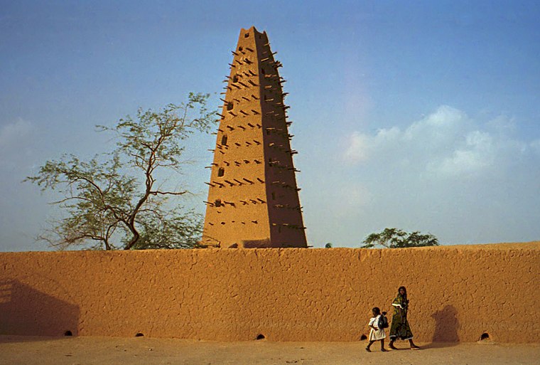
Photo: Dan Lundberg, CC BY-SA 2.0.
Agadez Mosque is a prominent mosque in Agadez, Tchirozerine Department, Niger. It was made of clay and is the tallest mud-brick structure in the world. Agadez Mosque is situated 3½ km northeast of École Primaire Dagamanet.
Places in the Area
Nearby places include Agadez.
Agadez
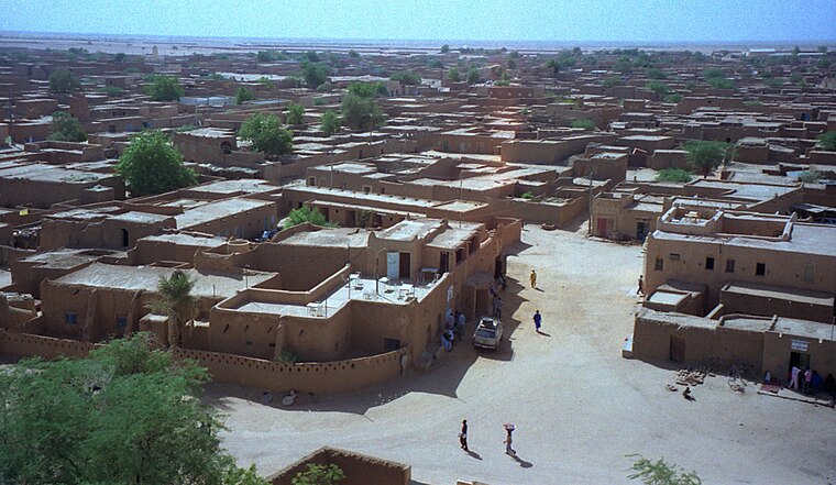
Photo: Dan Lundberg, CC BY-SA 2.0.
Agadez, formerly spelled Agadès, is the fifth largest city in Niger, with a population of 110,497 based on the 2012 census. The capital of the eponymous Agadez Region, the city lies in the Sahara desert, and is also the capital of Aïr, one of the traditional Tuareg–Berber federations.
École Primaire Dagamanet
Latitude
16.95273° or 16° 57′ 10″ northLongitude
7.96382° or 7° 57′ 50″ eastOpen location code
7F89XX37+3GOpenStreetMap ID
node 4414773856OpenStreetMap feature
amenity=school
This page is based on OpenStreetMap, Wikidata, and Wikimedia Commons.
We’d love your help improving our open data sources. Thank you for contributing.
Satellite Map
Discover École Primaire Dagamanet from above in high-definition satellite imagery.
Notable Places Nearby
Highlights include Hopital Djibril Kari Ousman - Centre de Meres et de l’Enfant and Bureau de Douane d’Agadez.
Nearby Places
Explore places such as École mederesa Dagmanett II and Alimentation Issoudar.
Niger: Must-Visit Destinations
Delve into Niamey, Agadez, Maradi, and W National Park.
Curious Schools to Discover
Uncover intriguing schools from every corner of the globe.
About Mapcarta. Data © OpenStreetMap contributors and available under the Open Database License". Text is available under the CC BY-SA 4.0 license, except for photos, directions, and the map. Photo: Jacques Taberlet, CC BY-SA 3.0.