Cranbrook House
Cranbrook House is a ruins in Australia. Cranbrook House is situated nearby to the dog park Dog Off-Leash Area, as well as near the playground Froggy Park.| Tap on a place to explore it |
Places of Interest Nearby
Highlights include Thomas Dixon Centre and Toowong Memorial Park.
Thomas Dixon Centre
Public building

Photo: Shiftchange, CC0.
Thomas Dixon Centre is a heritage-listed former factory and now a venue for the performing arts at 406 Montague Road, West End, Queensland, Australia. It was built in 1908. Thomas Dixon Centre is situated 450 metres east of Cranbrook House.
Toowong Memorial Park
Park
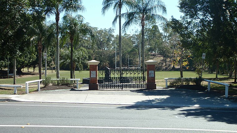 Toowong Memorial Park is a heritage-listed memorial and park at 65 Sylvan Road, Toowong, City of Brisbane, Queensland, Australia. It was designed by George Rae and built c. 1922 by Andrew Lang Petrie Monumental Works. Toowong Memorial Park is situated 1 km northwest of Cranbrook House.
Wesley Hospital
Hospital

Photo: Commander Keane, Public domain.
The Wesley Hospital is a private hospital located in the suburb of Auchenflower in Brisbane, Queensland, Australia. The hospital currently has over 530 beds and offers a large range of clinical services. Wesley Hospital is situated 1 km north of Cranbrook House.
Places in the Area
Nearby places include West End and South Bank.
West End
Suburb

Photo: Misaochan2, CC BY 4.0.
West End is an inner southern suburb in the City of Brisbane, Queensland, Australia. In the 2021 census, West End had a population of 14,730 people. The Aboriginal name for the area is Kurilpa, which means place of the water rat.
South Bank
Neighborhood

Photo: willislim, CC BY-SA 2.0.
South Bank is a cultural, social, educational and recreational precinct in Brisbane, Queensland, Australia. The precinct is located in the suburb of South Brisbane, on the southern bank of the Brisbane River. South Bank is situated 2½ km northeast of Cranbrook House.
Clarence Corner
Neighborhood

Photo: Wikimedia, Public domain.
Clarence Corner is the junction of Stanley Street and Annerley Road in Woolloongabba/South Brisbane in Brisbane, Queensland, Australia. It gives its name to the local area. Clarence Corner is situated 3 km east of Cranbrook House.
Cranbrook House
- Type: Ruins
- Category: historic site
- Location: Australia, Oceania
- View on OpenStreetMap
Latitude
-27.48664° or 27° 29′ 12″ southLongitude
152.99716° or 152° 59′ 50″ eastOpen location code
5R4JGX7W+8VOpenStreetMap ID
node 4489427039OpenStreetMap feature
historic=ruins
This page is based on OpenStreetMap, Wikidata, and Wikimedia Commons.
We’d love your help improving our open data sources. Thank you for contributing.
Satellite Map
Discover Cranbrook House from above in high-definition satellite imagery.
Places with the Same Name
Discover other places named “Cranbrook House”.
Notable Places Nearby
Highlights include Dog Off-Leash Area and Froggy Park.
Nearby Places
Explore places such as Cranbrook Place and R.G. (Bob) Longmore Memorial Boathouse.
Australia: Must-Visit Destinations
Delve into Sydney, Melbourne, Perth, and Canberra.
Curious Ruins to Discover
Uncover intriguing ruins from every corner of the globe.
About Mapcarta. Data © OpenStreetMap contributors and available under the Open Database License". Text is available under the CC BY-SA 4.0 license, except for photos, directions, and the map. Photo: Tiimta, CC BY-SA 3.0.