Battlefield Stores
Battlefield Stores is a convenience store in Newcastle upon Tyne, England. Battlefield Stores is situated nearby to Sallyport Or Wall Knoll Tower, as well as near City Church.| Tap on a place to explore it |
Places of Interest Nearby
Highlights include Gateshead Millennium Bridge and Baltic Centre for Contemporary Art.
Gateshead Millennium Bridge
Bridge
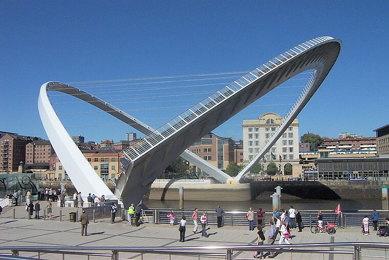
Photo: Mike1024, Public domain.
The Gateshead Millennium Bridge is a pedestrian and cyclist tilt bridge spanning the River Tyne between Gateshead arts quarter on the south bank and Newcastle upon Tyne's Quayside area on the north bank. Gateshead Millennium Bridge is situated 980 feet southeast of Battlefield Stores.
Baltic Centre for Contemporary Art
Arts center

Photo: 06benste, CC BY-SA 3.0.
Baltic Centre for Contemporary Art is a centre for contemporary art located on the south bank of the River Tyne in Gateshead, Tyne and Wear, England. It hosts a frequently changing variety of exhibitions, events, and educational programmes with no permanent exhibition. Baltic Centre for Contemporary Art is situated 1,300 feet southeast of Battlefield Stores.
St James’ Park
Stadium
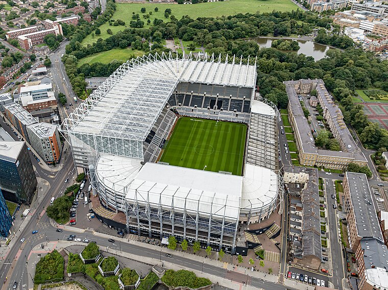
Photo: Arne mueseler, CC BY-SA 3.0 de.
St James' Park is a football stadium in Newcastle upon Tyne, England. It is the home of Newcastle United. With a seating capacity of 52,264, it is the 10th largest football stadium in England. St James’ Park is situated 1 mile west of Battlefield Stores.
Places in the Area
Nearby places include Battlefield and Grainger Town.

Grainger Town
Suburb

Photo: EL36ML, CC BY-SA 3.0.
Grainger Town is the historic commercial centre of Newcastle upon Tyne, England. It covers approximately 36 ha. Almost all of Grainger Town is in Newcastle's Central Conservation Area, one of the first designated in England.
Haymarket
Suburb
Haymarket is an area in the north of central Newcastle upon Tyne. The area has several transport hubs including Eldon Square bus station, Haymarket bus station and Haymarket Metro station.
Battlefield Stores
- Type: Convenience store
- Categories: shop and food
- Location: Newcastle upon Tyne, England, United Kingdom, Britain and Ireland, Europe
- View on OpenStreetMap
Latitude
54.97203° or 54° 58′ 19″ northLongitude
-1.60205° or 1° 36′ 7″ westOpen location code
9C6WX9CX+R5OpenStreetMap ID
node 4502253668OpenStreetMap feature
shop=convenience
This page is based on OpenStreetMap, Wikidata, and Wikimedia Commons.
We’d love your help improving our open data sources. Thank you for contributing.
Satellite Map
Discover Battlefield Stores from above in high-definition satellite imagery.
Notable Places Nearby
Highlights include Sallyport Or Wall Knoll Tower and City Church.
Nearby Places
Explore places such as Price Watch Supermarket and The Salvation Army Residential Centre.
England: Must-Visit Destinations
Delve into London, Manchester, Sheffield, and Leeds.
Curious Convenience Stores to Discover
Uncover intriguing convenience stores from every corner of the globe.
About Mapcarta. Data © OpenStreetMap contributors and available under the Open Database License". Text is available under the CC BY-SA 4.0 license, except for photos, directions, and the map. Photo: sidibousaid, CC BY 2.0.