پلی کلینیک امام رضا
پلی کلینیک امام رضا is a clinic in Markazi Province, Iran. پلی کلینیک امام رضا is situated nearby to the government office پلیس + ۱۰, as well as near اداره آموزش و پرورش استان مرکزی.| Tap on a place to explore it |
Places of Interest Nearby
Highlights include Arak and Four Seasons Bathhouse.
Arak
Railway station
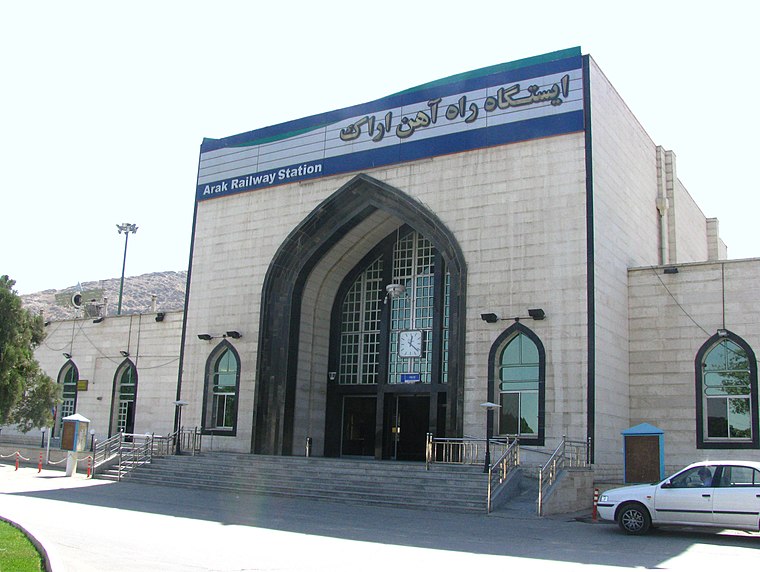 Arak is a railway station, which is situated 550 metres south of پلی کلینیک امام رضا.
Four Seasons Bathhouse
Museum

Photo: Kiantavakoli, CC BY-SA 4.0.
The Four-Season Bathhouse in the Iranian city Arak dates back to the Qajar period, and had two separate sections for ladies and gents. The tile-work of the clock room and spinal designed columns of this area, including the layout of the bath are interesting features. Four Seasons Bathhouse is situated 1½ km northwest of پلی کلینیک امام رضا.
Bazaar of Arak
Commercial area

Photo: Kiantavakoli, CC BY-SA 4.0.
The Bazaar of Arak is a bazaar, located in Arak, in the province of Markazi, Iran. It was one of the first constructed buildings in the city. The bazaar complex, containing a public bath, a mosque, water reservoirs, passages and caravansary, was built at the time of Fath-Ali Shah Qajar and by Yusef Khan-e Gorji, in the middle of Sultan Abad. Bazaar of Arak is situated 2 km northwest of پلی کلینیک امام رضا.
Places in the Area
Nearby places include Arak and Naz̧mābād.
Arak
 Arak, also known as Soltan Abad, is a major industrial city of 550,000 and the capital of Markazi Province in Western Iran.
Naz̧mābād
Village

Photo: Ali Sharifi, CC BY 3.0.
Nazmabad is a village in Sedeh Rural District, in the Central District of Arak County, Markazi Province, Iran. At the 2006 census, its population was 453, in 139 families. Naz̧mābād is situated 4 km southeast of پلی کلینیک امام رضا.
Cheqa, Markazi
Village
Cheqa is a village in Masumiyeh Rural District, in the Central District of Arak County, Markazi Province, Iran. At the 2006 census, its population was 55, in 13 families. Cheqa, Markazi is situated 7 km east of پلی کلینیک امام رضا.
پلی کلینیک امام رضا
- Type: Clinic
- Category: health care
- Location: Markazi Province, Iran, Middle East, Asia
- View on OpenStreetMap
Latitude
34.07676° or 34° 4′ 36″ northLongitude
49.70196° or 49° 42′ 7″ eastOpen location code
8H6F3PG2+PQOpenStreetMap ID
node 4560557952OpenStreetMap feature
amenity=clinicOpenStreetMap feature
healthcare=clinic
This page is based on OpenStreetMap, Wikidata, and Wikimedia Commons.
We’d love your help improving our open data sources. Thank you for contributing.
Satellite Map
Discover پلی کلینیک امام رضا from above in high-definition satellite imagery.
Notable Places Nearby
Highlights include پلیس + ۱۰ and اداره آموزش و پرورش استان مرکزی.
Nearby Places
Explore places such as داروخانه دکتر اطهری and ۶.
Iran: Must-Visit Destinations
Delve into Tehran, Isfahan, Tabriz, and Sistan and Baluchestan.
Curious Clinics to Discover
Uncover intriguing clinics from every corner of the globe.
About Mapcarta. Data © OpenStreetMap contributors and available under the Open Database License". Text is available under the CC BY-SA 4.0 license, except for photos, directions, and the map. Photo: Wikimedia, CC0.