471 Santa Lucia
471 Santa Lucia is a school in Santa Lucia, Lambare, Central Department. 471 Santa Lucia is situated nearby to the church La Iglesia de Jesucristo de los Santos de los Últimos Días, as well as near the park Plaza Mario A. Benitez.| Tap on a place to explore it |
Places of Interest Nearby
Highlights include Estadio Jardines del Kelito and Estadio Rogelio Livieres.
Estadio Jardines del Kelito
Stadium
Estadio Jardines del Kelito is a football stadium in Paraguay that is located in the city of Asunción. It is the home venue of River Plate Asunción. River Plate Asunción's former stadium, which was located in the Mariscal López and General Santos avenues, was previously known as Kelito after the club received a donation of brass from a factory named Helados Kelito. Estadio Jardines del Kelito is situated 3 km north of 471 Santa Lucia.
Estadio Rogelio Livieres
Pitch
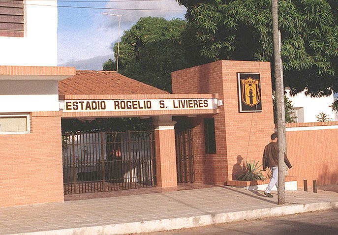
Photo: Edgar Andino, Public domain.
Estadio Rogelio Livieres is a multi-use stadium in Asunción, Paraguay. It is currently used mostly for football matches and is the home stadium of Club Guaraní. The stadium holds 8,000 people. Estadio Rogelio Livieres is situated 3½ km north of 471 Santa Lucia.
Iglesia San Nicolás y Santa Maria
Church

Photo: Roque curi1, Public domain.
Iglesia San Nicolás y Santa Maria is a church, which is situated 3 km west of 471 Santa Lucia.
Places in the Area
Nearby places include Terminal and Vista Alegre.
Terminal
Neighborhood
Terminal is a neighbourhood of Asunción, Paraguay. Its name is given by the fact that the Terminal de Ómnibus de Asunción, the city's main coach terminal, is located in this neighbourhood.
Hipódromo
Neighborhood
Hipódromo is a barrio of Asunción, the capital of Paraguay. It's a relatively new neighbourhood with a population of 8,348 people, and provides one of the biggest green areas in Asunción. Hipódromo is situated 2½ km northeast of 471 Santa Lucia.
471 Santa Lucia
- Type: School
- Category: education
- Location: Santa Lucia, Lambare, Central Department, Paraguay, South America
- View on OpenStreetMap
Latitude
-25.33311° or 25° 19′ 59″ southLongitude
-57.60292° or 57° 36′ 11″ westOpen location code
5864M98W+QROpenStreetMap ID
node 4575272685OpenStreetMap feature
amenity=school
This page is based on OpenStreetMap, Wikidata, and Wikimedia Commons.
We’d love your help improving our open data sources. Thank you for contributing.
Satellite Map
Discover 471 Santa Lucia from above in high-definition satellite imagery.
Notable Places Nearby
Highlights include La Iglesia de Jesucristo de los Santos de los Últimos Días and Plaza Mario A. Benitez.
Nearby Places
Explore places such as Cyber Mania and Digicentro.
Paraguay: Must-Visit Destinations
Delve into Asunción, Ciudad del Este, Encarnación, and Pedro Juan Caballero.
Curious Schools to Discover
Uncover intriguing schools from every corner of the globe.
About Mapcarta. Data © OpenStreetMap contributors and available under the Open Database License". Text is available under the CC BY-SA 4.0 license, except for photos, directions, and the map. Photo: Greg Schechter, CC BY 2.0.